File:South End-Groebeckville Historic District map.png

Size of this preview: 685 × 599 pixels. Other resolutions: 274 × 240 pixels | 549 × 480 pixels | 1,000 × 875 pixels.
Original file (1,000 × 875 pixels, file size: 531 KB, MIME type: image/png)
Captions
Captions
Add a one-line explanation of what this file represents
| Description | ||||
| Date | Overlays created 2012-09-13 prior to upload | |||
| Source | Own work and Open Street Map contributors | |||
| Author | Original map layer from OpenStreetMap; overlays by Daniel Case | |||
| Permission (Reusing this file) |
This file is licensed under the Creative Commons Attribution-Share Alike 2.0 Generic license.
|
File history
Click on a date/time to view the file as it appeared at that time.
| Date/Time | Thumbnail | Dimensions | User | Comment | |
|---|---|---|---|---|---|
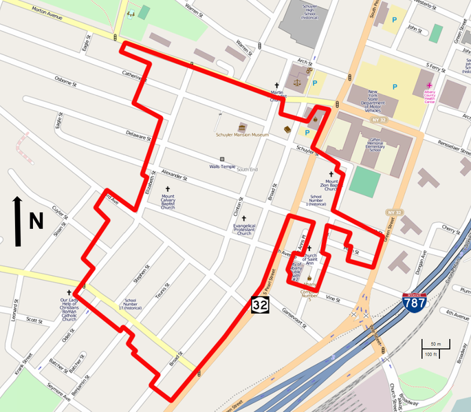
| current | 23:15, 13 September 2012 | | 1,000 × 875 (531 KB) | Daniel Case (talk | contribs) | {{Information |Description ={{en|1=Map of South End–Groesbeckville Historic District, Albany, NY, USA}} |Source ={{own}}{{Ope... |
You cannot overwrite this file.
File usage on Commons
There are no pages that use this file.
File usage on other wikis
The following other wikis use this file:
- Usage on en.wikipedia.org