File:South Tarawa (separated to north and south) - bel.svg

Size of this PNG preview of this SVG file: 600 × 600 pixels. Other resolutions: 240 × 240 pixels | 480 × 480 pixels | 768 × 768 pixels | 1,024 × 1,024 pixels | 2,048 × 2,048 pixels | 694 × 694 pixels.
Original file (SVG file, nominally 694 × 694 pixels, file size: 31 KB)
Captions
Captions
Add a one-line explanation of what this file represents
Summary edit
| Description |
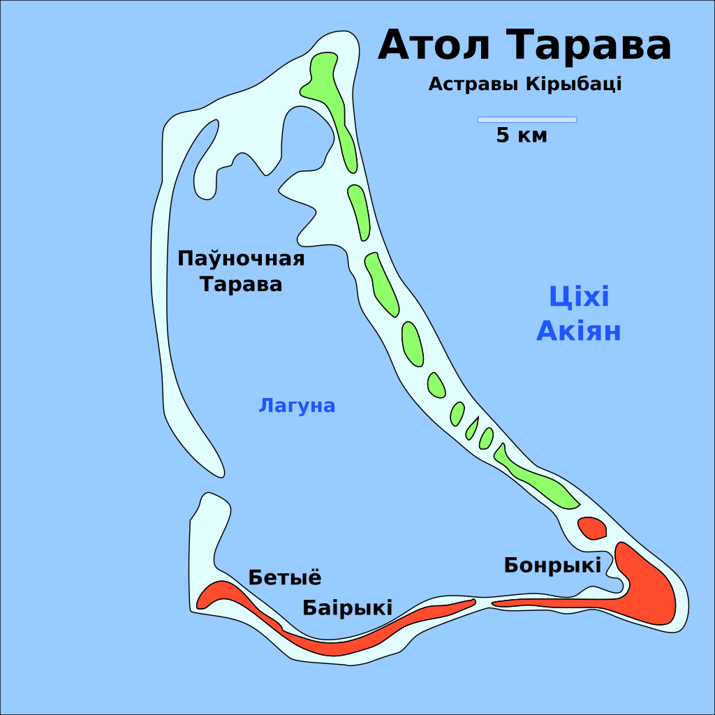
English: Locator map of the municipalities of South Tarawa (shown in orange) and North Tarawa (shown in green) within the atoll of Tarawa, in Kiribati, labeled in Belarusian.
Беларуская: Карта муніцыпалітэта Паўднёвая Тарава (аранжавая) і Паўночная Тарава (зялёная) унутры атола Тарава, у Кірыбаці, падпісаная па-беларуску. |
| Date | |
| Source | translated from File:South Tarawa (separated to north and south).svg |
| Author | Plaga med |
| Other versions |
|
| SVG development |


.png)
.svg)
_-_bel.svg&action=edit§ion=1)
| This is a retouched picture, which means that it has been digitally altered from its original version. Modifications: Belarusian translatiopn. The original can be viewed here: South Tarawa (separated to north and south).svg:
|
Licensing edit
_-_bel.svg&action=edit§ion=2)
I, the copyright holder of this work, hereby publish it under the following license:
| This file is made available under the Creative Commons CC0 1.0 Universal Public Domain Dedication. | |
| The person who associated a work with this deed has dedicated the work to the public domain by waiving all of their rights to the work worldwide under copyright law, including all related and neighboring rights, to the extent allowed by law. You can copy, modify, distribute and perform the work, even for commercial purposes, all without asking permission.
|
File history
Click on a date/time to view the file as it appeared at that time.
| Date/Time | Thumbnail | Dimensions | User | Comment | |
|---|---|---|---|---|---|
| current | 23:04, 28 February 2023 | | 694 × 694 (31 KB) | Plaga med (talk | contribs) | Uploaded own work with UploadWizard |
You cannot overwrite this file.
File usage on Commons
The following 4 pages use this file:
File usage on other wikis
The following other wikis use this file:
- Usage on be.wikipedia.org
_-_bel.svg&oldid=829970192)