File:South West England counties.png
Size of this preview: 800 × 585 pixels. Other resolutions: 320 × 234 pixels | 640 × 468 pixels | 1,024 × 748 pixels | 1,281 × 936 pixels.
Original file (1,281 × 936 pixels, file size: 258 KB, MIME type: image/png)
Captions
Captions
Add a one-line explanation of what this file represents
Summary edit
| Description |
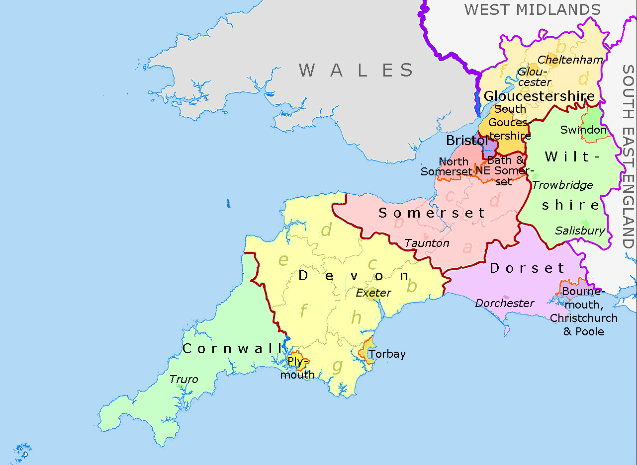
English: Map of the South West England region, showing its counties and administrative districts. The county colours are the same as those in File:English metropolitan and non-metropolitan counties 2009.svg.
Equirectangular map projection on WGS 84 datum, with N/S stretched 160% Geographic limits:
|
| Date | |
| Source |
File:SouthWest-local-government-2019.jpg This file was derived from: |
| Author |
Nilfanion, created using Ordnance Survey data
|

| Camera location | | View this and other nearby images on: OpenStreetMap |
|---|
Licensing edit
This file is licensed under the Creative Commons Attribution-Share Alike 4.0 International license.
- You are free:
- to share – to copy, distribute and transmit the work
- to remix – to adapt the work
- Under the following conditions:
- attribution – You must give appropriate credit, provide a link to the license, and indicate if changes were made. You may do so in any reasonable manner, but not in any way that suggests the licensor endorses you or your use.
- share alike – If you remix, transform, or build upon the material, you must distribute your contributions under the same or compatible license as the original.
File history
Click on a date/time to view the file as it appeared at that time.
| Date/Time | Thumbnail | Dimensions | User | Comment | |
|---|---|---|---|---|---|
| current | 23:48, 26 April 2022 | | 1,281 × 936 (258 KB) | Ulamm (talk | contribs) | {{Information |description={{en|1=Map of the South West England region, showing its counties and administrative districts. The county colours are the same as those in File:English metropolitan and non-metropolitan counties 2009.svg. Equirectangular map projection on WGS 84 datum, with N/S stretched 160% Geographic limits: *West: 6.5W *East: 1.4W *North: 52.2N *South: 49.7N}} |date=2019-04-06 |source=File:SouthWest-local-government-2019.jpg {{Derived... |
You cannot overwrite this file.
File usage on Commons
There are no pages that use this file.
File usage on other wikis
The following other wikis use this file:
- Usage on de.wikipedia.org