File:SouthernSectionUpperGeyserBasin.JPG
Size of this preview: 393 × 599 pixels. Other resolutions: 157 × 240 pixels | 315 × 480 pixels | 504 × 768 pixels | 1,230 × 1,874 pixels.
Original file (1,230 × 1,874 pixels, file size: 341 KB, MIME type: image/jpeg)
Captions
Captions
Add a one-line explanation of what this file represents
Summary edit
| Description |
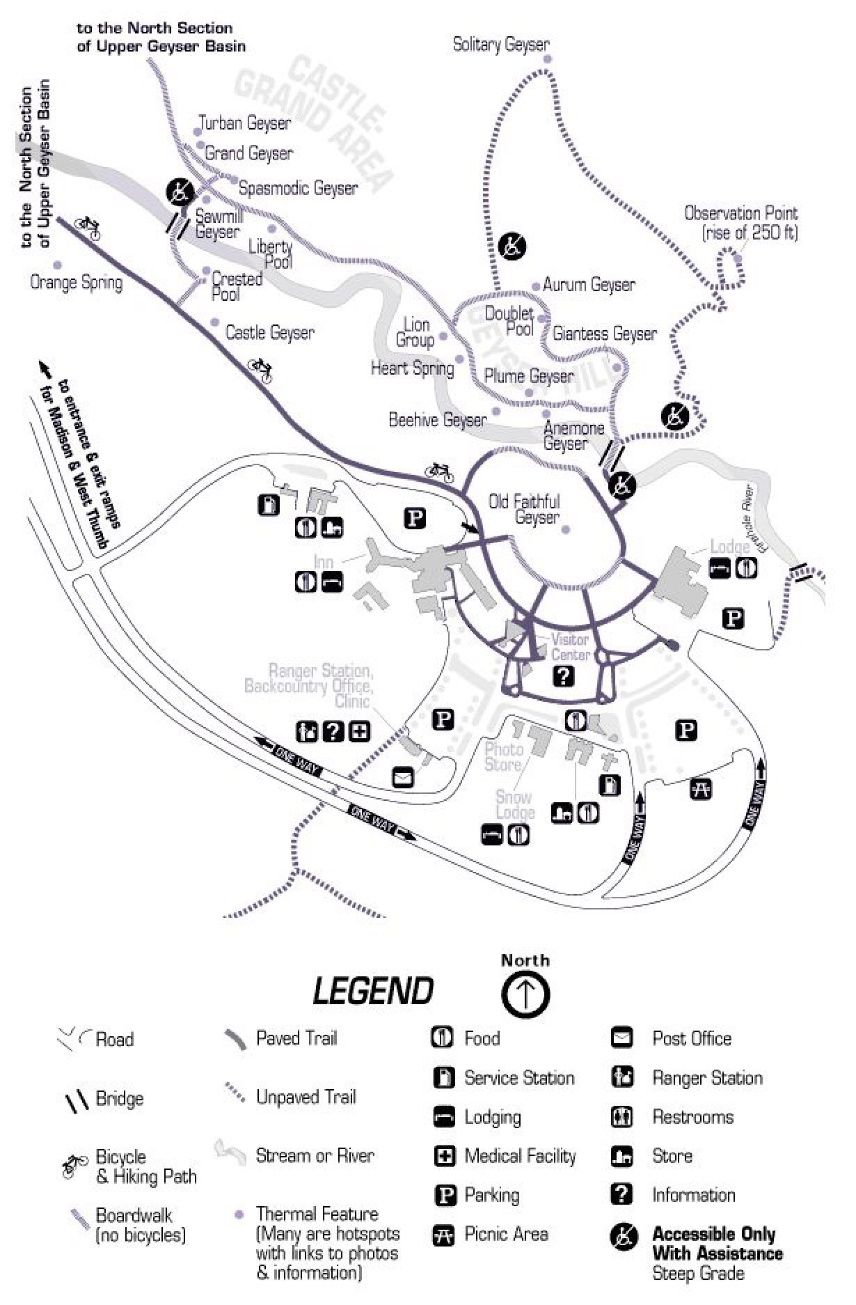
English: Map of southern section of Upper Geyser Basin, Yellowstone National Park, Wyoming |
| Date | |
| Source | Screen Captured from National Park Service website: http://www.nps.gov/archive/yell/tours/oldfaithful/oftourmap.htm |
| Author | NPS |
Licensing edit
| This image or media file contains material based on a work of a National Park Service employee, created as part of that person's official duties. As a work of the U.S. federal government, such work is in the public domain in the United States. See the NPS website and NPS copyright policy for more information. |
File history
Click on a date/time to view the file as it appeared at that time.
| Date/Time | Thumbnail | Dimensions | User | Comment | |
|---|---|---|---|---|---|
| current | 20:26, 18 February 2009 | | 1,230 × 1,874 (341 KB) | Mike Cline (talk | contribs) | {{Information |Description={{en|1=Map of southern section of Upper Geyser Basin, Yellowstone National Park, Wyoming}} |Source=Screen Captured from National Park Service website: http://www.nps.gov/archive/yell/tours/oldfaithful/oftourmap.htm |Author=NPS | |
You cannot overwrite this file.
File usage on Commons
There are no pages that use this file.
File usage on other wikis
The following other wikis use this file:
- Usage on nl.wikipedia.org