File:Southold-town-map.gif
No higher resolution available.
Southold-town-map.gif (575 × 425 pixels, file size: 51 KB, MIME type: image/gif)
Captions
Captions
Add a one-line explanation of what this file represents
Summary edit
| Description | |
| Date | |
| Source | http://factfinder.census.gov |
| Author | United States Census Bureau |
| Permission (Reusing this file) |
Public domain |
Licensing edit
This image or file is a work of a United States Census Bureau employee, taken or made as part of that person's official duties. As a work of the U.S. federal government, the image is in the public domain.
|
 |
Original upload log edit
Transferred from en.wikipedia to Commons by Cocoloi using CommonsHelper.
The original description page was here. All following user names refer to en.wikipedia.
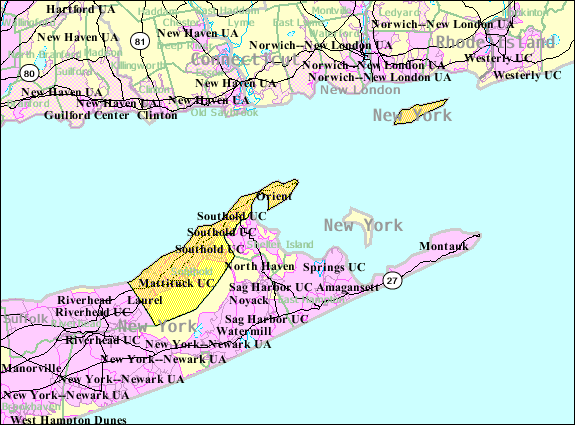
- 2007-10-22 10:57 Americasroof 575×425× (52662 bytes) [[Southold, New York]] map from U.S. Census
File history
Click on a date/time to view the file as it appeared at that time.
| Date/Time | Thumbnail | Dimensions | User | Comment | |
|---|---|---|---|---|---|
| current | 12:30, 9 May 2009 | | 575 × 425 (51 KB) | File Upload Bot (Magnus Manske) (talk | contribs) | {{BotMoveToCommons|en.wikipedia|year={{subst:CURRENTYEAR}}|month={{subst:CURRENTMONTHNAME}}|day={{subst:CURRENTDAY}}}} {{Information |Description={{en|en:U.S. Census 2000 reference map for en:Southold, New York}} |Source=Transferred from [htt |
You cannot overwrite this file.
File usage on Commons
The following page uses this file:
File usage on other wikis
The following other wikis use this file:
- Usage on azb.wikipedia.org
- Usage on ceb.wikipedia.org
- Usage on de.wikipedia.org
- Usage on en.wikipedia.org
- Usage on es.wikipedia.org
- Usage on fr.wikipedia.org
- Usage on ht.wikipedia.org
- Usage on www.wikidata.org
- Usage on zh.wikipedia.org