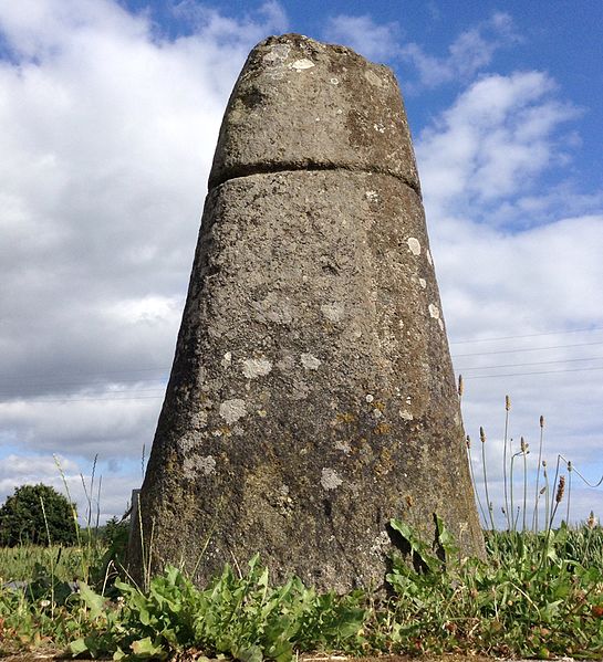
File:Stèles-du-Moustoir Plélauff France.jpg

Original file (1,936 × 2,129 pixels, file size: 1.92 MB, MIME type: image/jpeg)
Captions
Captions
Summary edit
| DescriptionStèles-du-Moustoir Plélauff France.jpg |
Français : Stèle dite du « Moustoir » de l'âge du Fer, donc datant de l'époque protohistorique, taillée dans du granit et de forme tronconique. Hauteur 1,59 m (Cf. Jean-Yves Éveillard, « Notes sur quelques stèles inédites des environs de Rostrenen », dans Mémoires de la Société d'Émulation des Côtes-du-Nord, n° 100, 1971 [1972] p. 24. Carte archéologique de la Gaule : 22. Côtes-d'Armor, 2002, p. 217 et fig. 209). Elle est localisée au carrefour de la D 76 et du chemin du Moustoir, dans la commune de Plélauff (Côtes-d'Armor). Sans référence scientifique, elle aurait parfois été considérée hypothétiquement comme une borne milliaire. |
| Date | |
| Source | Own work |
| Author | Piero |
| Camera location | 48° 11′ 34.14″ N, 3° 13′ 06.34″ W | View this and other nearby images on: OpenStreetMap |
|---|
Licensing edit
| This file is made available under the Creative Commons CC0 1.0 Universal Public Domain Dedication. | |
| The person who associated a work with this deed has dedicated the work to the public domain by waiving all of their rights to the work worldwide under copyright law, including all related and neighboring rights, to the extent allowed by law. You can copy, modify, distribute and perform the work, even for commercial purposes, all without asking permission.
http://creativecommons.org/publicdomain/zero/1.0/deed.enCC0Creative Commons Zero, Public Domain Dedicationfalsefalse |
File history
Click on a date/time to view the file as it appeared at that time.
| Date/Time | Thumbnail | Dimensions | User | Comment | |
|---|---|---|---|---|---|
| current | 13:55, 9 October 2016 |  | 1,936 × 2,129 (1.92 MB) | Piero~commonswiki (talk | contribs) | User created page with UploadWizard |
You cannot overwrite this file.
File usage on Commons
There are no pages that use this file.
File usage on other wikis
The following other wikis use this file:
- Usage on fr.wikipedia.org
Metadata
This file contains additional information such as Exif metadata which may have been added by the digital camera, scanner, or software program used to create or digitize it. If the file has been modified from its original state, some details such as the timestamp may not fully reflect those of the original file. The timestamp is only as accurate as the clock in the camera, and it may be completely wrong.
| Width | 1,936 px |
|---|---|
| Height | 2,129 px |
| Orientation | Normal |
| File change date and time | 14:22, 9 October 2016 |
| Y and C positioning | Centered |
| Exif version | 2.21 |
| Meaning of each component |
|
| Supported Flashpix version | 1 |
| Color space | sRGB |