File:St Botolph's church - grave - geograph.org.uk - 855657.jpg
Size of this preview: 450 × 600 pixels. Other resolutions: 180 × 240 pixels | 480 × 640 pixels.
Original file (480 × 640 pixels, file size: 196 KB, MIME type: image/jpeg)
Captions
Captions
Add a one-line explanation of what this file represents
Summary edit
| Description |
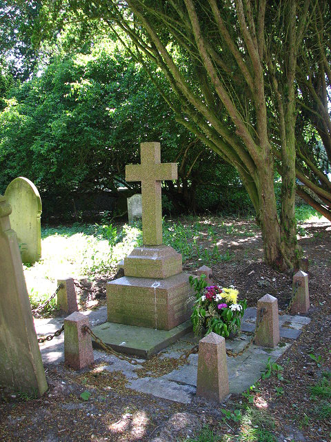
English: St Botolph's church - grave. The grave of the Rev Henry John Coleman, an enthusiastic bee keeper and rector here 120-odd years ago; the stained glass roundels in the church windows - some depicting bees > 855661 - were funded by him from the proceeds of the sale of his honey.
St Botolph's church > https://www.geograph.org.uk/photo/855647 - https://www.geograph.org.uk/photo/855670 - https://www.geograph.org.uk/photo/855676 stands in the grounds of Westwick Hall - home to the Berneys and later the Petres - hemmed in by tall trees on three sides and hence difficult to photograph. The church was extensively restored by J Petre in 1845. There are several C18 and C19 wall monuments > https://www.geograph.org.uk/photo/851893 and the east window is by Heaton, Butler and Bayne (1898) > https://www.geograph.org.uk/photo/855660. Other windows contain C19 glass roundels, some depicting bees. These were funded by the Rev Henry John Coleman > https://www.geograph.org.uk/photo/855657 - the then rector and an enthusiastic bee keeper - from the proceeds of the sale of his honey. The font dates from the early 16th century > https://www.geograph.org.uk/photo/855679 - https://www.geograph.org.uk/photo/855681 as does the restored rood screen > https://www.geograph.org.uk/photo/855666 - https://www.geograph.org.uk/photo/855667. The church is kept locked but a key is available. For more information see: http://www.norfolkchurches.co.uk/westwick/westwick.htm |
| Date | |
| Source | From geograph.org.uk |
| Author | Evelyn Simak |
| Attribution (required by the license) | Evelyn Simak / St Botolph's church - grave / |
| Camera location | | View this and other nearby images on: OpenStreetMap |
|---|
_heading:202.00&language=en)
| Object location | | View this and other nearby images on: OpenStreetMap |
|---|
_heading:202.00&language=en)
Licensing edit

|
This image was taken from the Geograph project collection. See this photograph's page on the Geograph website for the photographer's contact details. The copyright on this image is owned by Evelyn Simak and is licensed for reuse under the Creative Commons Attribution-ShareAlike 2.0 license.
|
This file is licensed under the Creative Commons Attribution-Share Alike 2.0 Generic license.
Attribution: Evelyn Simak
- You are free:
- to share – to copy, distribute and transmit the work
- to remix – to adapt the work
- Under the following conditions:
- attribution – You must give appropriate credit, provide a link to the license, and indicate if changes were made. You may do so in any reasonable manner, but not in any way that suggests the licensor endorses you or your use.
- share alike – If you remix, transform, or build upon the material, you must distribute your contributions under the same or compatible license as the original.
File history
Click on a date/time to view the file as it appeared at that time.
| Date/Time | Thumbnail | Dimensions | User | Comment | |
|---|---|---|---|---|---|
| current | 03:22, 21 February 2011 | | 480 × 640 (196 KB) | GeographBot (talk | contribs) | == {{int:filedesc}} == {{Information |description={{en|1=St Botolph's church - grave The grave of the Rev Henry John Coleman, an enthusiastic bee keeper and rector here 120-odd years ago; the stained glass roundels in the church windows - some depicting b |
You cannot overwrite this file.
File usage on Commons
There are no pages that use this file.