File:St Clair Tunnel USGS image.jpg

Size of this preview: 800 × 316 pixels. Other resolutions: 320 × 126 pixels | 640 × 253 pixels | 1,270 × 502 pixels.
Original file (1,270 × 502 pixels, file size: 161 KB, MIME type: image/jpeg)
Captions
Captions
Add a one-line explanation of what this file represents
Summary edit
| Description |
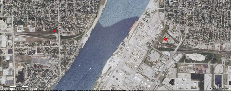
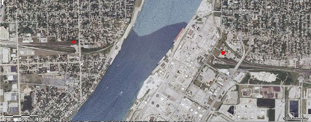
English: Map showing both entrances to the St. Clair River Tunnel, marked here with red dots. Michigan on the left, Ontario on the right. |
| Date | |
| Source | USGS National Map, http://viewer.nationalmap.gov/viewer/?p=default&b=base3&x=-9175034.046315873&y=5305756.124645077&l=15&v=vectorSelectablePolygons%3A10 |
| Author | USGS |
Licensing edit
This image is in the public domain in the United States because it only contains materials that originally came from the United States Geological Survey, an agency of the United States Department of the Interior. For more information, see the official USGS copyright policy.
|
File history
Click on a date/time to view the file as it appeared at that time.
| Date/Time | Thumbnail | Dimensions | User | Comment | |
|---|---|---|---|---|---|
| current | 14:00, 21 March 2014 | 1,270 × 502 (161 KB) | Oaktree b (talk | contribs) | User created page with UploadWizard |
You cannot overwrite this file.
File usage on Commons
There are no pages that use this file.
File usage on other wikis
The following other wikis use this file:
- Usage on fr.wikipedia.org