File:Stepnica (gmina) location map.png

Size of this preview: 799 × 599 pixels. Other resolutions: 320 × 240 pixels | 640 × 480 pixels | 1,024 × 768 pixels | 1,361 × 1,021 pixels.
Original file (1,361 × 1,021 pixels, file size: 120 KB, MIME type: image/png)
Captions
Captions
Add a one-line explanation of what this file represents
| Description |
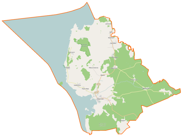
Polski: Mapa gminy Stepnica, Polska
English: Map of Gmina Stepnica, Poland |
|||||||||
| Date | ||||||||||
| Source | You may find a page on the OpenStreetMap wiki page for Stepnica (gmina) | |||||||||
| Creator |
OpenStreetMap contributors OpenStreetMap contributors |
|||||||||
| Permission (Reusing this file) |
OpenStreetMap data is available under the Open Database License (details). Map tiles are licensed under the Creative Commons Attribution-ShareAlike 2.0 license (CC-BY-SA 2.0).
This file is licensed under the Creative Commons Attribution-Share Alike 2.0 Generic license.
|
|||||||||
| Geotemporal data | ||||||||||
| Bounding box |
|
|||||||||
| Georeferencing | If inappropriate please set warp_status = skip to hide. | |||||||||
File history
Click on a date/time to view the file as it appeared at that time.
| Date/Time | Thumbnail | Dimensions | User | Comment | |
|---|---|---|---|---|---|
| current | 06:42, 6 March 2015 | | 1,361 × 1,021 (120 KB) | VanWiel (talk | contribs) | {{OpenStreetMap | name = Stepnica (gmina) | location = Stepnica (gmina) | description = {{pl|Mapa gminy Stepnica, Polska}} {{en|Map of Gmina Stepnica, Poland}} | top = 53.7998 | bottom = 53.5922 | l... |
You cannot overwrite this file.
File usage on Commons
There are no pages that use this file.
File usage on other wikis
The following other wikis use this file:
- Usage on fr.wikipedia.org
- Stepnica
- Bogusławie
- Borowice (Poméranie-Occidentale)
- Budzień
- Czarnocin (Poméranie-Occidentale)
- Gąsierzyno
- Jarszewko
- Kopice (Poméranie-Occidentale)
- Krokorzyce
- Łąka (Goleniów)
- Miłowo (Poméranie-Occidentale)
- Piaski Małe
- Racimierz (Goleniów)
- Rogów (Poméranie-Occidentale)
- Stepniczka
- Widzieńsko
- Żarnówko
- Żarnowo (Goleniów)
- Zielonczyn (Poméranie-Occidentale)
- Usage on pl.wikipedia.org
- Stepnica
- Widzieńsko
- Bogusławie
- Stepnica (gmina)
- Budzień
- Czarnocin (województwo zachodniopomorskie)
- Gąsierzyno
- Jarszewko
- Kopice (województwo zachodniopomorskie)
- Krokorzyce
- Łąka (powiat goleniowski)
- Miłowo (województwo zachodniopomorskie)
- Piaski Małe
- Racimierz (powiat goleniowski)
- Stepniczka
- Świętowice
- Żarnowo (powiat goleniowski)
- Żarnówko
- Zielonczyn (województwo zachodniopomorskie)
- Rezerwat przyrody Białodrzew Kopicki
- Rezerwat przyrody Czarnocin im. prof. Janiny Jasnowskiej
- Wichowska Kępa
- Rogów (województwo zachodniopomorskie)
- Borowice (województwo zachodniopomorskie)
- Port morski Stepnica
- Trzęsacz (jezioro)
- Zielonczyn (jezioro)
- Jezioro Dołgie (powiat goleniowski)
- Rezerwat przyrody Olszanka (województwo zachodniopomorskie)
- Zatoka na Palach
- Zatoka Stepnicka
View more global usage of this file.
_location_map.png)
_location_map.png&oldid=505333402)