File:StraßenbahnGleisplanGOP2016.png

Size of this preview: 800 × 479 pixels. Other resolutions: 320 × 191 pixels | 640 × 383 pixels | 1,024 × 613 pixels | 1,280 × 766 pixels | 2,560 × 1,531 pixels | 13,375 × 8,001 pixels.
Original file (13,375 × 8,001 pixels, file size: 2.85 MB, MIME type: image/png)
Captions
Captions
Add a one-line explanation of what this file represents
Summary edit
| Warning | The original file is very high-resolution. It might not load properly or could cause your browser to freeze when opened at full size. |
|---|
| Description |
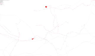
Polski: Mapa torowa tramwajowej sieci w Górnośląskim Okręgu Przemysłowym (wschodnia strona) 2016
Deutsch: Straßenbahn-Gleisplan GOP (Oberschlesien), Ostteil 2016 |
| Date | |
| Source | Own work |
| Author | Stef.muc |
| Permission (Reusing this file) |
This file is licensed under the Creative Commons Attribution-Share Alike 3.0 Germany license.
 |
File history
Click on a date/time to view the file as it appeared at that time.
| Date/Time | Thumbnail | Dimensions | User | Comment | |
|---|---|---|---|---|---|
| current | 13:15, 4 October 2016 | | 13,375 × 8,001 (2.85 MB) | Stef.muc (talk | contribs) | {{Information |Description ={{pl|1=Kolejowa mapa tramwajowej sieci w Górnośląskim Okręgu Przemysłowym (wschódnia strona) 2016}} {{de|1=Straßenbahn-Gleisplan GOP (Oberschlesien), Ostteil 2016}} |Source ={{own}} |Author =[[User:... |
You cannot overwrite this file.
File usage on Commons
There are no pages that use this file.