File:Straßenbrunnen208 Wittenau Am Nordgraben Rathauspromenade (1).jpg

Size of this preview: 450 × 600 pixels. Other resolutions: 180 × 240 pixels | 360 × 480 pixels | 576 × 768 pixels | 768 × 1,024 pixels | 1,536 × 2,048 pixels | 3,106 × 4,141 pixels.
Original file (3,106 × 4,141 pixels, file size: 2.91 MB, MIME type: image/jpeg)
Captions
Captions
Add a one-line explanation of what this file represents
Summary
edit.jpg&action=edit§ion=1)
| Description |
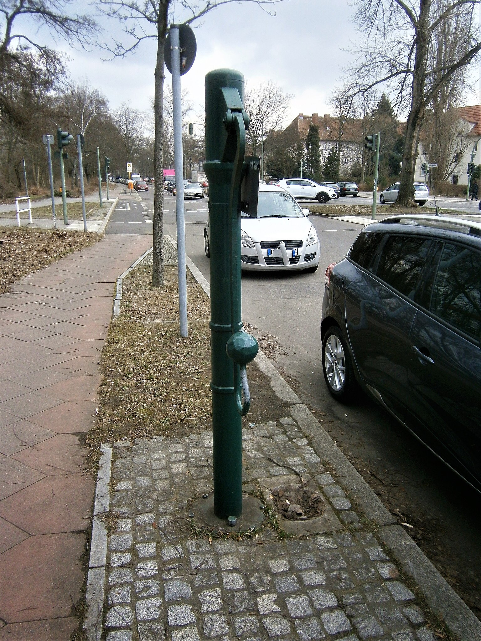
Deutsch: Der Standort ist nach der Landesliste[1] mit Brunnen Am Nordgraben - STRB (PLZ: 13437) notiert. Zur PLZ 13437 gehören in Wittenau die Grundstücke 6–15 sowie weiter in Reinickendorf Am Nordgraben 30 und 31. (Planungsraum Wittenau Süd oder Teichstraße) Dies entspricht dem Straßenlauf zwischen Eichborndamm und Oranienburger Straße. Der Brunnen steht am nördlichen Gehsteig von Am Nordgraben nahe zum tiefliegenden Nordgraben. Über den Graben hinweg liegt der Peter-Witte-Park zu dem ein Steg führt, der Rathauspromenade und Techowstraße verbindet. Die U-Bahn-Station Rathaus Reinickendorf befindet sich 200 Meter nach Westen. Vom Brunnenstandort über die 30 Meter breite Straße Am Nordgraben steht die Peter-Witte-Schule (Rathauspromenade 75[2] an der Westecke Rathauspromenade.[3] Der Brunnenfuß zwischen Radweg und Bordsteinkante im Baumstreifen ist vom Pflastermosaik umgeben. Die Ovalmuldenplatte befindet sich dabei zur Fahrbahn hin und nicht unter dem Wasseraustritt der gegenüber zum Schwengel parallel zum Gehsteig angebracht ist. |
| Date | |
| Source | Own work |
| Author | Boonekamp (ergo) Günter Haase |
| Camera location | | View this and other nearby images on: OpenStreetMap |
|---|
.jpg¶ms=052.587508_N_0013.329592_E_globe:Earth_type:camera__&language=en)
Licensing
edit.jpg&action=edit§ion=2)
I, the copyright holder of this work, hereby publish it under the following license:
This file is licensed under the Creative Commons Attribution-Share Alike 4.0 International license.
- You are free:
- to share – to copy, distribute and transmit the work
- to remix – to adapt the work
- Under the following conditions:
- attribution – You must give appropriate credit, provide a link to the license, and indicate if changes were made. You may do so in any reasonable manner, but not in any way that suggests the licensor endorses you or your use.
- share alike – If you remix, transform, or build upon the material, you must distribute your contributions under the same or compatible license as the original.
- ↑ Cite error: Invalid
<ref>tag; no text was provided for refs namedds17-15418 - ↑ Kalifornische Architektur im märkischen Sand - das Schulgebäude
- ↑ Schulchronik - 1780 bis 19711780 wurde auf der Dorfaue nahe der noch vorhandenen Dorfkirche ein Schulhaus errichtet. 1972 entstand das neue Schulgebäude.
File history
Click on a date/time to view the file as it appeared at that time.
| Date/Time | Thumbnail | Dimensions | User | Comment | |
|---|---|---|---|---|---|
| current | 11:33, 28 February 2019 | | 3,106 × 4,141 (2.91 MB) | Boonekamp (talk | contribs) | User created page with UploadWizard |
You cannot overwrite this file.
File usage on Commons
The following page uses this file:
File usage on other wikis
The following other wikis use this file:
- Usage on de.wikipedia.org
.jpg&oldid=505958689)