File:Strait of Tartary (MODIS 2018-11-04).jpg

Size of this preview: 698 × 599 pixels. Other resolutions: 280 × 240 pixels | 559 × 480 pixels | 894 × 768 pixels | 1,193 × 1,024 pixels | 2,499 × 2,146 pixels.
Original file (2,499 × 2,146 pixels, file size: 702 KB, MIME type: image/jpeg)
Captions
Captions
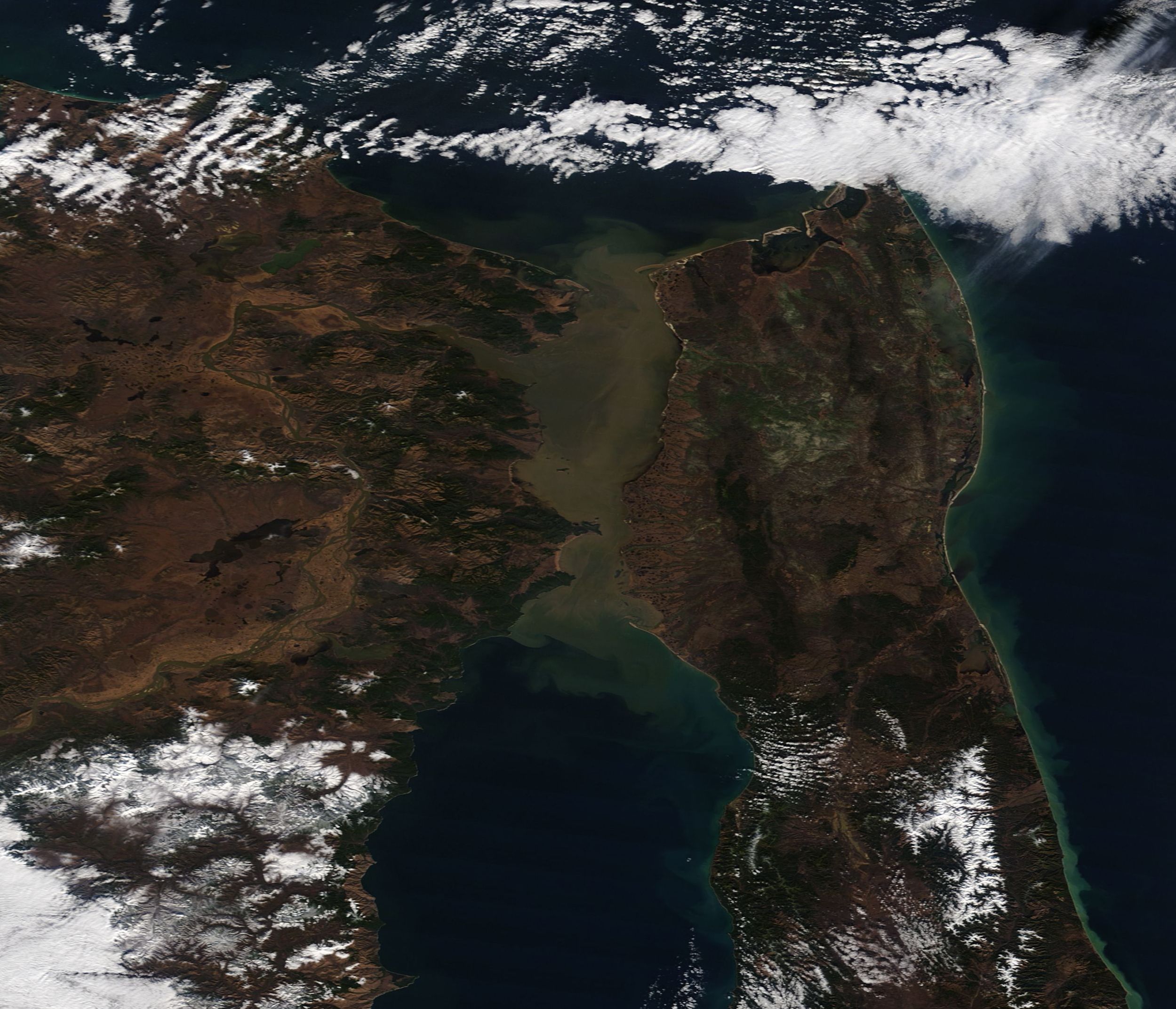
On November 1, 2018, NASA’s Terra satellite passed over eastern Russia, allowing the Moderate Resolution Imaging Spectroradiometer (MODIS) flying on board to acquire a true-color image of the Strait of Tartary.
Summary edit
.jpg&action=edit§ion=1)
| Description |
English: On November 1, 2018, NASA’s Terra satellite passed over eastern Russia, allowing the Moderate Resolution Imaging Spectroradiometer (MODIS) flying on board to acquire a true-color image of the Strait of Tartary.
The Strait of Tartary separates the Russian mainland from Sakhalin Island and connects the Sea of Okhotsk (north) from the Sea of Japan (south). The strait stretches about 213 miles (342 km) at the widest point and constricts to 4.5 mi (7 km) at the narrowest, and is about 393 mmi (632 km) long. The shallow strait is an important summer-time shipping center and the home to several Russian ports. Typically by mid-November ice begins to impede the waterway and it may stay frozen until May. The brown color comes from sediment flowing in from the Amur River, which winds more than 2,700 miles (4,444 km) from its source in Mongolia, through China, and through Russia’s Far East before it pours into the Tartary Strait. It is the tenth longest river in the world. |
||
| Date | Taken on 1 November 2018 | ||
| Source |
Strait of Tartary (direct link)
|
||
| Author | MODIS Land Rapid Response Team, NASA GSFC |
| This media is a product of the Terra mission Credit and attribution belongs to the mission team, if not already specified in the "author" row |
Licensing edit
.jpg&action=edit§ion=2)
| This file is in the public domain in the United States because it was solely created by NASA. NASA copyright policy states that "NASA material is not protected by copyright unless noted". (See Template:PD-USGov, NASA copyright policy page or JPL Image Use Policy.) | ||
 |
Warnings:
|
File history
Click on a date/time to view the file as it appeared at that time.
| Date/Time | Thumbnail | Dimensions | User | Comment | |
|---|---|---|---|---|---|
| current | 01:24, 17 February 2024 | | 2,499 × 2,146 (702 KB) | OptimusPrimeBot (talk | contribs) | #Spacemedia - Upload of http://modis.gsfc.nasa.gov/gallery/images/image11042018_250m.jpg via Commons:Spacemedia |
You cannot overwrite this file.
File usage on Commons
There are no pages that use this file.
.jpg&oldid=852758034)