File:Lautém posto administrativo.png
(Redirected from File:Subdistrikt Lautem Suco.png)

Size of this preview: 800 × 476 pixels. Other resolutions: 320 × 190 pixels | 640 × 381 pixels | 1,024 × 609 pixels | 1,640 × 976 pixels.
Original file (1,640 × 976 pixels, file size: 414 KB, MIME type: image/png)
Captions
Captions
Add a one-line explanation of what this file represents
Summary edit
| Description |
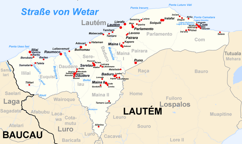
English: Map of subdistrict of Lautém, district Lautém, Timor-Leste
Deutsch: Karte des Subdistrikts Lautém, Distrikt Lautém, Timor-Leste |
| Date | 01/06/2009 |
| Source | Own work |
| Author | J. Patrick Fischer |
Licensing edit
I, the copyright holder of this work, hereby publish it under the following license:
This file is licensed under the Creative Commons Attribution-Share Alike 3.0 Unported license.
- You are free:
- to share – to copy, distribute and transmit the work
- to remix – to adapt the work
- Under the following conditions:
- attribution – You must give appropriate credit, provide a link to the license, and indicate if changes were made. You may do so in any reasonable manner, but not in any way that suggests the licensor endorses you or your use.
- share alike – If you remix, transform, or build upon the material, you must distribute your contributions under the same or compatible license as the original.
File history
Click on a date/time to view the file as it appeared at that time.
| Date/Time | Thumbnail | Dimensions | User | Comment | |
|---|---|---|---|---|---|
| current | 18:02, 26 April 2014 | | 1,640 × 976 (414 KB) | J. Patrick Fischer (talk | contribs) | Lagoa dos Macacos added |
| 13:50, 23 January 2010 |  | 1,640 × 976 (392 KB) | J. Patrick Fischer (talk | contribs) | Iralafai added | |
| 21:29, 22 January 2010 |  | 1,640 × 976 (405 KB) | J. Patrick Fischer (talk | contribs) | Village of Pairara added | |
| 13:23, 18 January 2010 |  | 1,640 × 976 (393 KB) | J. Patrick Fischer (talk | contribs) | New version by using File:Administrative map of the Lautem district of East Timor.png of Maximilian Dörrbecker (Chumwa) and new geographical names and spelling according Ministerial Document 199/2009, | |
| 18:51, 8 July 2009 |  | 2,075 × 1,265 (1.47 MB) | J. Patrick Fischer (talk | contribs) | Borders of Suco Luro | |
| 18:13, 5 July 2009 |  | 2,075 × 1,265 (1.42 MB) | J. Patrick Fischer (talk | contribs) | Correct new map | |
| 18:08, 5 July 2009 |  | 2,075 × 1,265 (1.52 MB) | J. Patrick Fischer (talk | contribs) | Reverted to version as of 20:41, 12 June 2009 | |
| 18:06, 5 July 2009 |  | 3,028 × 2,300 (2.79 MB) | J. Patrick Fischer (talk | contribs) | Correction borders of Suco Luro | |
| 20:41, 12 June 2009 |  | 2,075 × 1,265 (1.52 MB) | J. Patrick Fischer (talk | contribs) | some new river names | |
| 20:55, 4 June 2009 |  | 2,075 × 1,265 (1.43 MB) | J. Patrick Fischer (talk | contribs) | Correction in subdistrict Lauro |
You cannot overwrite this file.
File usage on Commons
The following 2 pages use this file:
- Atlas of East Timor
- File:Subdistrikt Lautem Suco.png (file redirect)
File usage on other wikis
The following other wikis use this file:
- Usage on de.wikipedia.org
- Usage on de.wikivoyage.org
- Usage on pl.wikipedia.org
- Usage on pt.wikipedia.org
- Usage on tet.wikipedia.org