File:Suedlicher Basisendpunkt 03.jpg
Size of this preview: 800 × 450 pixels. Other resolutions: 320 × 180 pixels | 640 × 360 pixels | 1,024 × 576 pixels | 1,280 × 720 pixels | 3,264 × 1,836 pixels.
Original file (3,264 × 1,836 pixels, file size: 2.73 MB, MIME type: image/jpeg)
Captions
Captions
Add a one-line explanation of what this file represents
Summary edit
| Description |
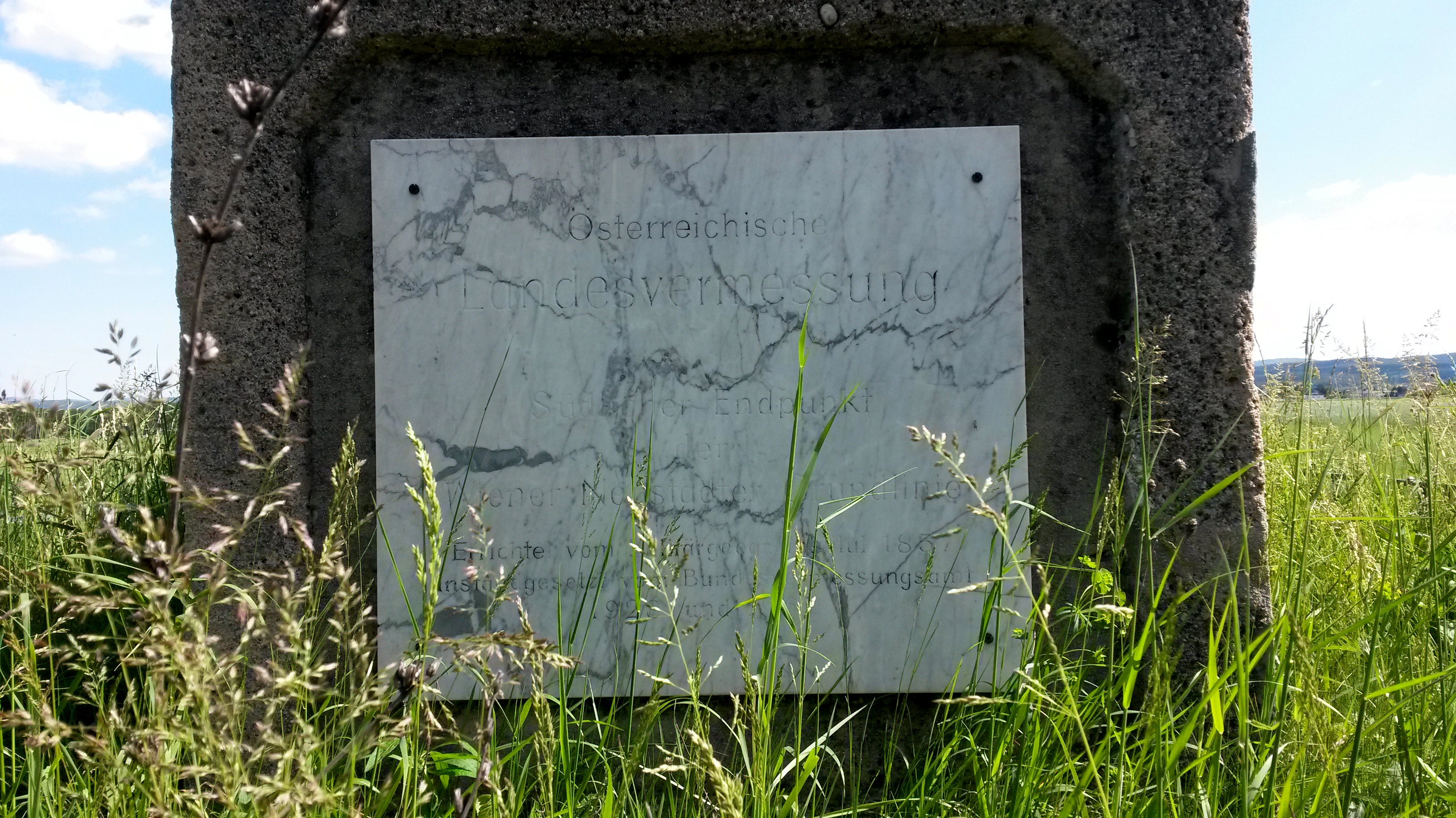
Deutsch: Informationstafel am Gedenkstein am Südlichen Basisendpunkt der Wiener Neustädter Grundlinie, Stadtgemeinde Neunkirchen, Niederösterreich. Text:Österreichische Landesvermessung/Südlicher Endpunkt der Wiener Neustädter Grundlinie/Errichtet vom Militärgeogr[aphischen]. Institut 1857/Instandgesetzt vom Bundesvermessungsamt 1928 und 1967 English: Memorial plate on the monument marking the Southern End of Wiener Neustadt Base Line in Neunkirchen town, reading, Survey of Austria/Southern End of Wiener Neustadt Base Line/Erected by the Military's Geographical Institute in 1857/Refurbished by the Federal Surveying Agency in 1928 and 1967 |
| Date | |
| Source | Own work |
| Author | Wolfgang Glock |
| Object location | | View this and other nearby images on: OpenStreetMap |
|---|
| Camera location | | View this and other nearby images on: OpenStreetMap |
|---|
Licensing edit
I, the copyright holder of this work, hereby publish it under the following licenses:

|
Permission is granted to copy, distribute and/or modify this document under the terms of the GNU Free Documentation License, Version 1.2 or any later version published by the Free Software Foundation; with no Invariant Sections, no Front-Cover Texts, and no Back-Cover Texts. A copy of the license is included in the section entitled GNU Free Documentation License. |
This file is licensed under the Creative Commons Attribution-Share Alike 3.0 Unported, 2.5 Generic, 2.0 Generic and 1.0 Generic license.
- You are free:
- to share – to copy, distribute and transmit the work
- to remix – to adapt the work
- Under the following conditions:
- attribution – You must give appropriate credit, provide a link to the license, and indicate if changes were made. You may do so in any reasonable manner, but not in any way that suggests the licensor endorses you or your use.
- share alike – If you remix, transform, or build upon the material, you must distribute your contributions under the same or compatible license as the original.
You may select the license of your choice.
File history
Click on a date/time to view the file as it appeared at that time.
| Date/Time | Thumbnail | Dimensions | User | Comment | |
|---|---|---|---|---|---|
| current | 22:30, 4 May 2014 | | 3,264 × 1,836 (2.73 MB) | Wolfgang glock (talk | contribs) | {{Information |Description ={{de|1=Informationstafel am Südlichen Basisendpunkt der Wiener Neustädter Grundlinie, Gemeinde Neunkirchen, Niederösterreich.<br/>Text:''Südlicher Endpunkt der Wiener Neustädter Grundlinie. Errichtet vom Militärgeog... |
You cannot overwrite this file.
File usage on Commons
The following page uses this file:
File usage on other wikis
The following other wikis use this file:
- Usage on de.wikipedia.org
- Usage on www.wikidata.org