File:Summitnavigationlight3.jpg
Summitnavigationlight3.jpg (640 × 479 pixels, file size: 104 KB, MIME type: image/jpeg)
File information
Structured data
Captions
Captions
Add a one-line explanation of what this file represents
Summary edit
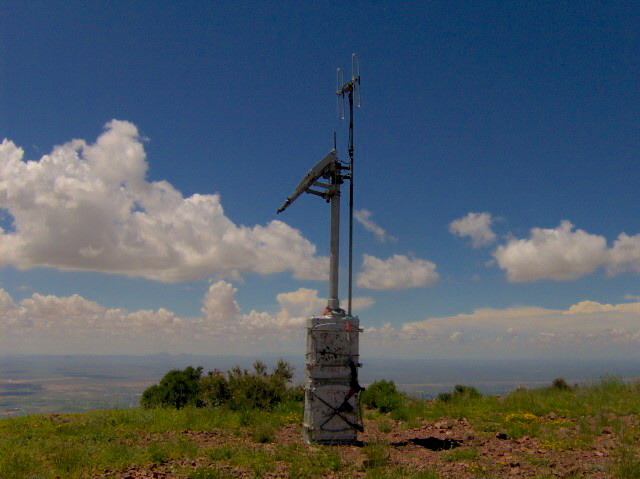
| DescriptionSummitnavigationlight3.jpg | A HAM radio repeater at the summit of North Franklin Mountain, in El Paso, Texas. The Mesilla Valley is below. The repeater is maintained by the West Texas Repeater Association with the permission of Franklin Mountains State Park. The tower also contains an emergency locator transmitter (ELT) provided by the Federal Aviation Administration that helps locate distressed aircraft. The Ham radio site is unique in being one of the first to be powered with solar cells. The radio equipment is contained in an old railroad signal box that was flown to the mountain top by military helicopter as a training flight. The Current call sign is K5ELP. |
| Date | |
| Source | Own work |
| Author | Brian Stansberry |
Licensing edit
I, Brian Stansberry, the copyright holder of this work, hereby publishes it under the following licenses:

|
Permission is granted to copy, distribute and/or modify this document under the terms of the GNU Free Documentation License, Version 1.2 or any later version published by the Free Software Foundation; with no Invariant Sections, no Front-Cover Texts, and no Back-Cover Texts. A copy of the license is included in the section entitled GNU Free Documentation License.http://www.gnu.org/copyleft/fdl.htmlGFDLGNU Free Documentation Licensetruetrue |
| This file is licensed under the Creative Commons Attribution-Share Alike 3.0 Unported license. | ||
| Attribution: I, Brian Stansberry | ||
| ||
| This licensing tag was added to this file as part of the GFDL licensing update.http://creativecommons.org/licenses/by-sa/3.0/CC BY-SA 3.0Creative Commons Attribution-Share Alike 3.0truetrue |
This file is licensed under the Creative Commons Attribution 2.5 Generic license.
Attribution: I, Brian Stansberry
- You are free:
- to share – to copy, distribute and transmit the work
- to remix – to adapt the work
- Under the following conditions:
- attribution – You must give appropriate credit, provide a link to the license, and indicate if changes were made. You may do so in any reasonable manner, but not in any way that suggests the licensor endorses you or your use.
You may select the license of your choice.
File history
Click on a date/time to view the file as it appeared at that time.
| Date/Time | Thumbnail | Dimensions | User | Comment | |
|---|---|---|---|---|---|
| current | 19:58, 13 August 2007 |  | 640 × 479 (104 KB) | BrineStans (talk | contribs) | {{Information |Description=A now-defunct navigation light at the summit of North Franklin Mountain, in El Paso, Texas. The Mesilla Valley is below. |Source=self-made |Date=9/5/2006 |Author= Brian Stansberry }} |
You cannot overwrite this file.
File usage on Commons
There are no pages that use this file.
File usage on other wikis
The following other wikis use this file:
- Usage on en.wikipedia.org
Metadata
This file contains additional information such as Exif metadata which may have been added by the digital camera, scanner, or software program used to create or digitize it. If the file has been modified from its original state, some details such as the timestamp may not fully reflect those of the original file. The timestamp is only as accurate as the clock in the camera, and it may be completely wrong.
| Horizontal resolution | 300 dpi |
|---|---|
| Vertical resolution | 300 dpi |
| Y and C positioning | Co-sited |
| Exif version | 2.2 |
| Color space | sRGB |
