File:Sumner Butte.jpg
Size of this preview: 800 × 533 pixels. Other resolutions: 320 × 213 pixels | 640 × 427 pixels | 1,024 × 683 pixels | 1,280 × 853 pixels | 3,000 × 2,000 pixels.
Original file (3,000 × 2,000 pixels, file size: 4.7 MB, MIME type: image/jpeg)
Captions
Captions
Add a one-line explanation of what this file represents
Summary edit
| Description |
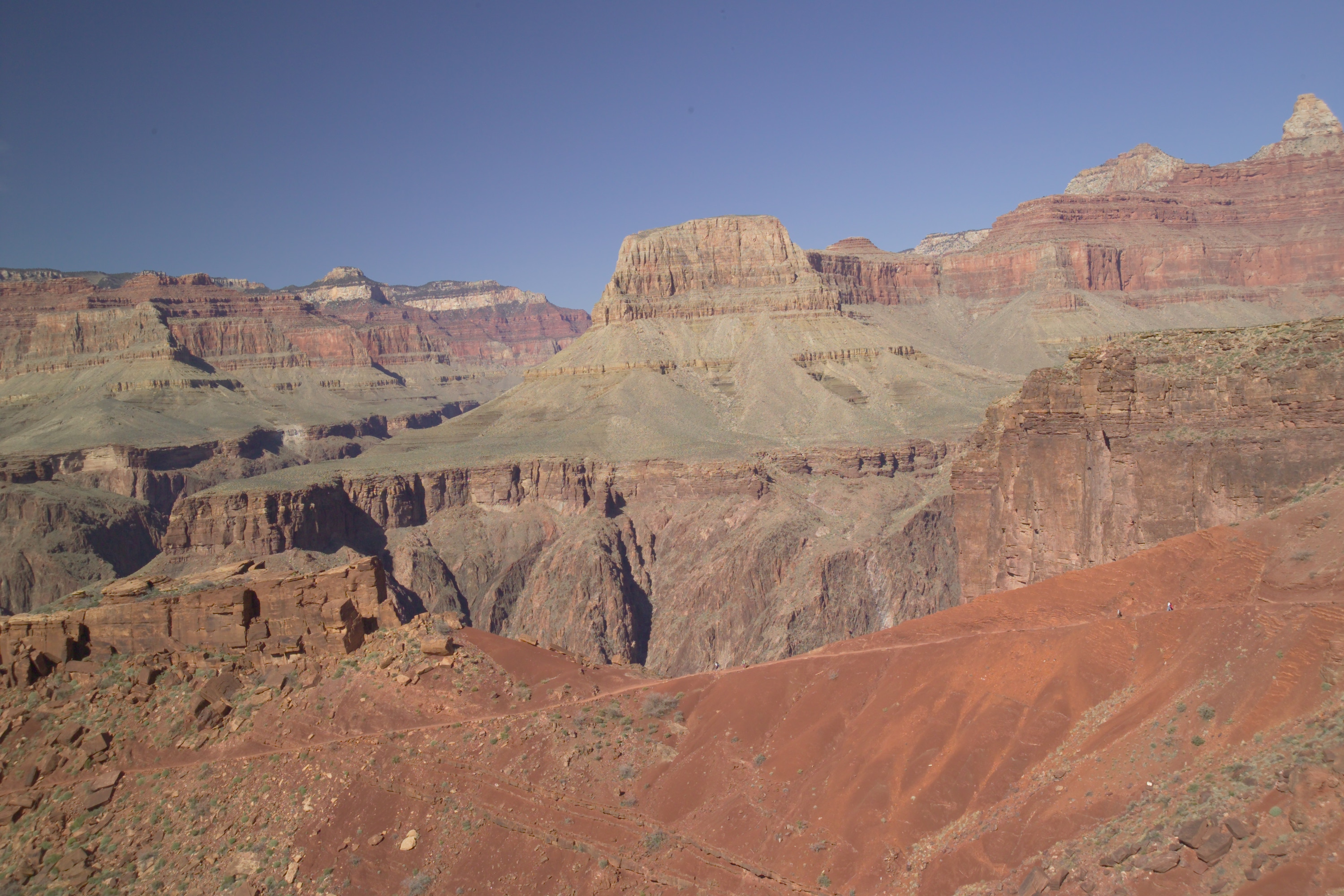
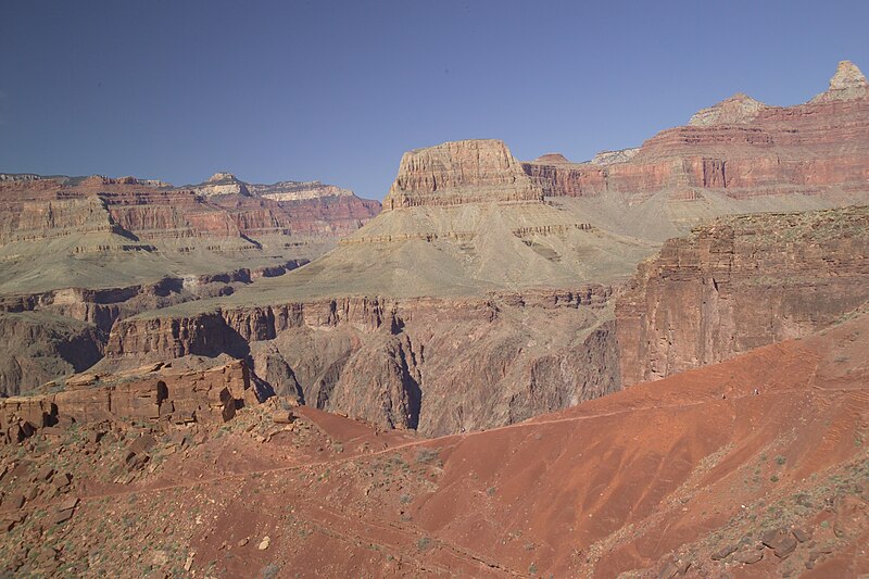
English: View of Sumner Butte from the South Kaibab Trail, Grand Canyon, Arizona US. (Note)--The en:Clear Creek Trail climbs out of Bright Angel Canyon, photo left, below the cliff above Granite Gorge. Sumner Butte (the Point): the trail enters just below the center of Sumner Butte's slopes, the slopes of Bright Angel Shale, below Muav Limestone. Clear Creek Trail goes east, (on Tonto Platform), then climbs up through parts of Zoroaster Canyon, at southeast flank of Zoroaster Temple, (Zoroaster Tower), a sub-prominence to Brahma Temple. Clear Creek Trail ends at a lower, middle section of Clear Creek (Arizona), (a drainage trying to cut off another portion of the Walhalla Plateau, (Kaibab Plaeau); Walhalla is also a cut-off portion of the Kaibab Plateau). |
| Date | |
| Source | Own work |
| Author | Strother |
| Object location | | View this and other nearby images on: OpenStreetMap |
|---|
| Camera location | | View this and other nearby images on: OpenStreetMap |
|---|
Licensing edit
I, the copyright holder of this work, hereby publish it under the following license:
This file is licensed under the Creative Commons Attribution-Share Alike 3.0 Unported license.
- You are free:
- to share – to copy, distribute and transmit the work
- to remix – to adapt the work
- Under the following conditions:
- attribution – You must give appropriate credit, provide a link to the license, and indicate if changes were made. You may do so in any reasonable manner, but not in any way that suggests the licensor endorses you or your use.
- share alike – If you remix, transform, or build upon the material, you must distribute your contributions under the same or compatible license as the original.
| Annotations | This image is annotated: View the annotations at Commons |
File history
Click on a date/time to view the file as it appeared at that time.
| Date/Time | Thumbnail | Dimensions | User | Comment | |
|---|---|---|---|---|---|
| current | 14:00, 20 June 2010 | | 3,000 × 2,000 (4.7 MB) | Strother~commonswiki (talk | contribs) | {{Information |Description={{en|1=View of Utah Flats from the South Kaibab Trail, Grand Canyon, Arizona US}} |Source={{own}} |Author=Strother |Date= |Permission= |other_versions= }} Category:Grand Canyon |
You cannot overwrite this file.
File usage on Commons
The following 4 pages use this file:
.jpg)
File usage on other wikis
The following other wikis use this file:
- Usage on de.wikipedia.org
- Usage on en.wikipedia.org
- Usage on www.wikidata.org