File:Survey of Israel, כנתלה (FL147408985 2694743).jpg

Size of this preview: 714 × 599 pixels. Other resolutions: 286 × 240 pixels | 572 × 480 pixels | 915 × 768 pixels | 1,220 × 1,024 pixels | 2,440 × 2,048 pixels | 14,454 × 12,131 pixels.
Original file (14,454 × 12,131 pixels, file size: 205.07 MB, MIME type: image/jpeg)
Captions
Captions
Add a one-line explanation of what this file represents
Summary edit
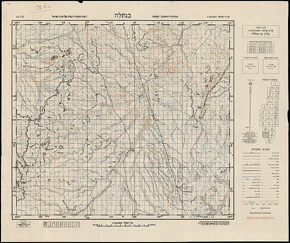
| Survey of Israel: כנתלה
( |
||||||||||||||||||||||||
|---|---|---|---|---|---|---|---|---|---|---|---|---|---|---|---|---|---|---|---|---|---|---|---|---|
| Artist | ||||||||||||||||||||||||
| Title |
כנתלה |
|||||||||||||||||||||||
| Publisher |
מחלקת המדידות |
|||||||||||||||||||||||
| Description |
כנתלה. עובד,שורטט והודפס עי מחלקת המדידות של מדינת ישראל בשיתוף עם שרות מפות וצלומים, צבא-הגנה לישראל... מאי 1949.. . |
|||||||||||||||||||||||
| Language | Hebrew | |||||||||||||||||||||||
| Publication date | 1949 | |||||||||||||||||||||||
| Medium | 1 גליון ; | |||||||||||||||||||||||
| Dimensions | height: 51 cm (20 in); width: 61 cm (24 in) | |||||||||||||||||||||||
| Collection |
|
|||||||||||||||||||||||
| Current location |
|
|||||||||||||||||||||||
| Place of publication | Israel | |||||||||||||||||||||||
| search Merhav catalog | Israel | |||||||||||||||||||||||
| Notes |
ראה חוברת: רשימת הכפרים הערביים בארץ ישראל לפי מפת 1:100,000, תשרי תשח. בתוך: pal 1154 עברית: ארץ ישראל 1:100,000 ; 22 | |||||||||||||||||||||||
| scale | 1:100,000 cm | |||||||||||||||||||||||
| IE PID | IE147408983 | |||||||||||||||||||||||
| Rosetta filename | FL147408985 | |||||||||||||||||||||||
| NNL item ID (P3959) | 990026947430205171 | |||||||||||||||||||||||
| search Merhav catalog | Hebrew, Survey of Israel | |||||||||||||||||||||||
| search Merhav catalog | מחלקת המדידות | |||||||||||||||||||||||
| Source/Photographer |
|
|||||||||||||||||||||||
| Other versions | ||||||||||||||||||||||||
| Jpg / Tif version |
|
|||||||||||||||||||||||

.jpg)

.jpg&action=edit§ion=1)
Licensing edit
.jpg&action=edit§ion=2)
This work created by the United Kingdom Government is in the public domain.
This is because it is one of the following:
HMSO has declared that the expiry of Crown Copyrights applies worldwide (ref: HMSO Email Reply)
|
 |
This work was created or ordered by the State of Israel, and is in the public domain because it satisfies one of the conditions stipulated in Israel's copyright statute from 2007 (translation) regarding the State's copyrights:
|

|
File history
Click on a date/time to view the file as it appeared at that time.
| Date/Time | Thumbnail | Dimensions | User | Comment | |
|---|---|---|---|---|---|
| current | 04:30, 22 August 2023 | | 14,454 × 12,131 (205.07 MB) | Geagea (talk | contribs) | pattypan 22.03 |
You cannot overwrite this file.
File usage on Commons
The following page uses this file:
.jpg&oldid=799930326)