File:Syna Most sur la carte de Brüx.jpg
Size of this preview: 448 × 599 pixels. Other resolutions: 179 × 240 pixels | 604 × 808 pixels.
Original file (604 × 808 pixels, file size: 573 KB, MIME type: image/jpeg)
Captions
Captions
Add a one-line explanation of what this file represents
Summary edit
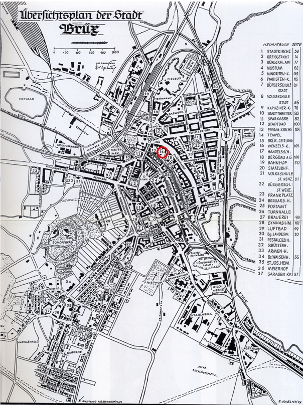
| Description | Map of Brüx (Most) in Czech Republic before WWI with mention of the location of the synagogue |
| Date | before WWI |
| Source | map |
| Author | Unknown author |
Licensing edit
|
This work is in the public domain in its country of origin and other countries and areas where the copyright term is the author's life plus 70 years or fewer. This work is in the public domain in the United States because it was published (or registered with the U.S. Copyright Office) before January 1, 1929. | |
| This file has been identified as being free of known restrictions under copyright law, including all related and neighboring rights. | |
File history
Click on a date/time to view the file as it appeared at that time.
| Date/Time | Thumbnail | Dimensions | User | Comment | |
|---|---|---|---|---|---|
| current | 13:53, 29 November 2023 | | 604 × 808 (573 KB) | FLLL (talk | contribs) | {{Information |Description= Map of Brüx (Most) in Czech Republic before WWI with mention of the location of the synagogue |Source= map |Date= before WWI |Author= unknown |Permission= |other_versions= }} Category:Synagogue in Most Category:Maps of Most |
You cannot overwrite this file.
File usage on Commons
The following page uses this file:
File usage on other wikis
The following other wikis use this file:
- Usage on fr.wikipedia.org