File:Syrtis-Isidis zoom 64 pano.jpg

Size of this preview: 800 × 556 pixels. Other resolutions: 320 × 222 pixels | 640 × 444 pixels | 1,024 × 711 pixels | 1,280 × 889 pixels | 2,560 × 1,778 pixels | 3,600 × 2,500 pixels.
Original file (3,600 × 2,500 pixels, file size: 4.28 MB, MIME type: image/jpeg)
Captions
Captions
Add a one-line explanation of what this file represents
Summary edit
| Description |
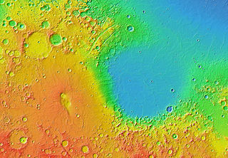
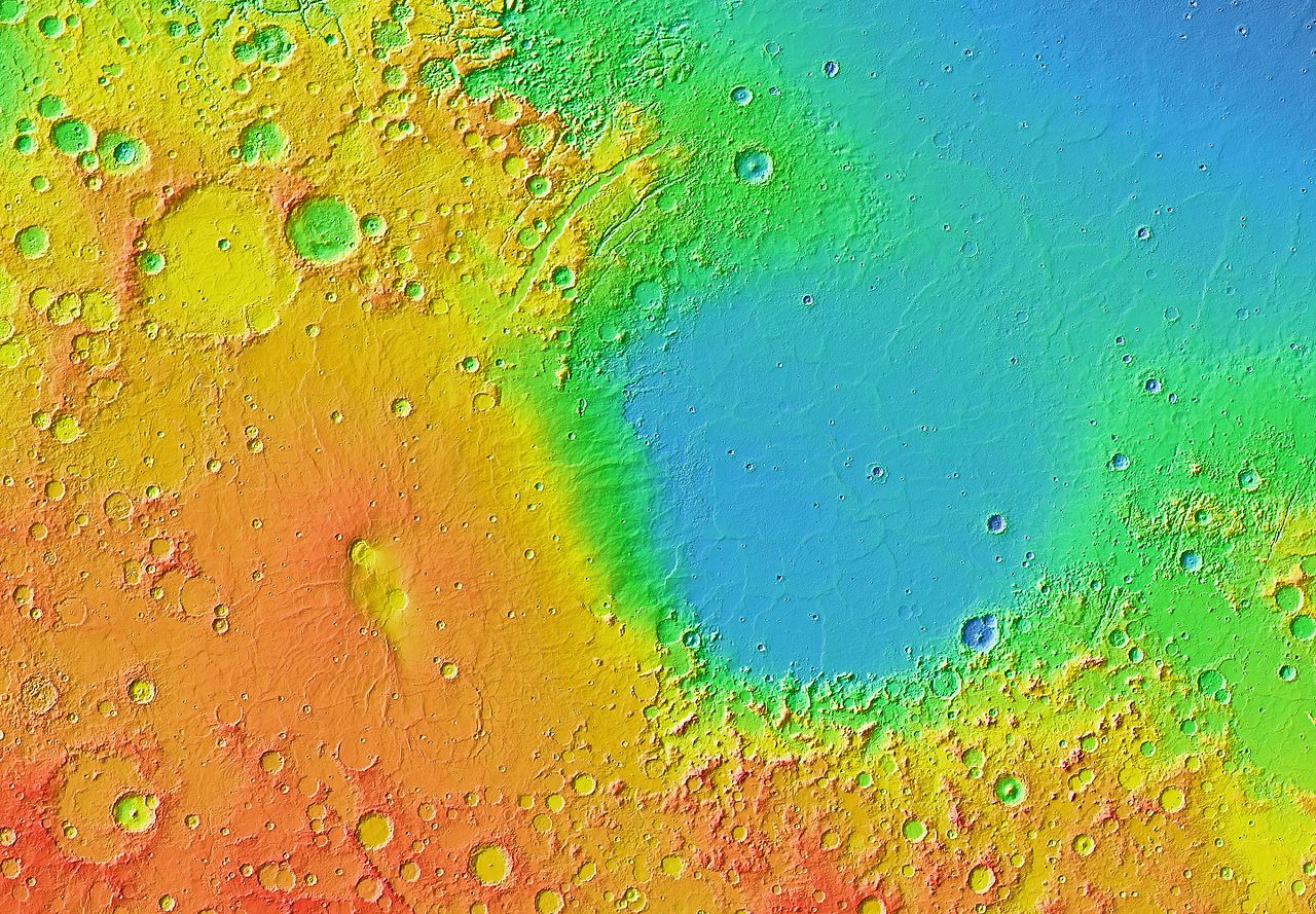
English: Mars Orbiter Laser Altimeter (MOLA) colorized topographic map showing the impact basin Isidis Planitia (right) and the broad, low-lying shield volcano Syrtis Major Planum (left), just north of the equator in the eastern hemisphere of Mars. Isidis is the third largest of the obvious impact basins on the planet. The calderas Nili Patera (upper left) and Meroe Patera (lower right) are visible within the central region of Syrtis Major. Some of the features in this image are annotated in Wikimedia Commons. |
| Date | |
| Source | JMARS |
| Author | NASA / JPL-Caltech / Arizona State University |
| Other versions |
 |
Licensing edit
| This file is in the public domain in the United States because it was solely created by NASA. NASA copyright policy states that "NASA material is not protected by copyright unless noted". (See Template:PD-USGov, NASA copyright policy page or JPL Image Use Policy.) | ||
 |
Warnings:
|
| Annotations | This image is annotated: View the annotations at Commons |
File history
Click on a date/time to view the file as it appeared at that time.
| Date/Time | Thumbnail | Dimensions | User | Comment | |
|---|---|---|---|---|---|
| current | 07:04, 30 March 2013 | | 3,600 × 2,500 (4.28 MB) | WolfmanSF (talk | contribs) | User created page with UploadWizard |
You cannot overwrite this file.
File usage on Commons
There are no pages that use this file.
File usage on other wikis
The following other wikis use this file:
- Usage on ca.wikipedia.org
- Usage on el.wikipedia.org
- Usage on en.wikipedia.org
- Usage on eo.wikipedia.org
- Usage on fr.wikipedia.org
- Usage on it.wikipedia.org
- Usage on ja.wikipedia.org
- Usage on uk.wikipedia.org