File:Szarvasi Vízi Színház panoráma - panoramio.jpg

Size of this preview: 800 × 280 pixels. Other resolutions: 320 × 112 pixels | 640 × 224 pixels | 1,024 × 359 pixels | 1,280 × 448 pixels | 4,755 × 1,665 pixels.
Original file (4,755 × 1,665 pixels, file size: 1.86 MB, MIME type: image/jpeg)
Captions
Captions
Add a one-line explanation of what this file represents
Summary
edit
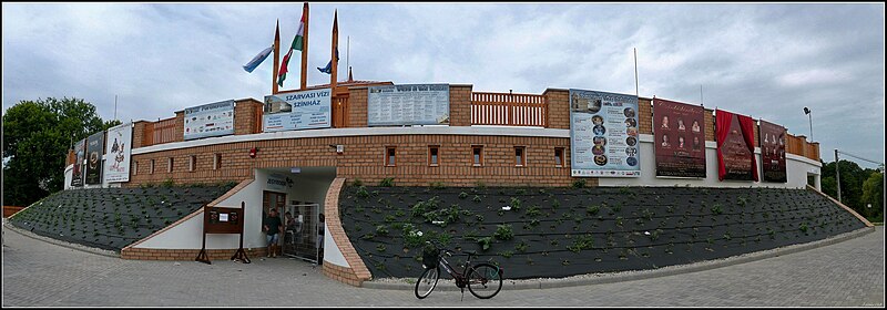
| Description | Szarvasi Vízi Színház. Szabadtéri játszóhely 2011 júniusa óta. Szarvason, a festői szépségű Holt-Körös partján egy különleges atmoszférájú, közel ezer ember befogadására alkalmas színház. Működtetője a Békéscsabai Jókai Színház. - Békés megye, Szarvas, Petőfi utca 7 | ||||
| Date | 27 April 2012 (original upload date) | ||||
| Source | https://web.archive.org/web/20161027053340/http://www.panoramio.com/photo/71025911 | ||||
| Author | Szemes Elek | ||||
| Permission (Reusing this file) |
This file is licensed under the Creative Commons Attribution-Share Alike 3.0 Unported license. Attribution: Szemes Elek
|
||||
| Tags (from Panoramio photo page) | Szarvas, 2011, Magyarország, Szarvas |
| Camera location | | View this and other nearby images on: OpenStreetMap |
|---|
File history
Click on a date/time to view the file as it appeared at that time.
| Date/Time | Thumbnail | Dimensions | User | Comment | |
|---|---|---|---|---|---|
| current | 13:00, 30 December 2016 | 4,755 × 1,665 (1.86 MB) | Panoramio upload bot (talk | contribs) | == {{int:filedesc}} == {{Information |description=Színházi panoráma |date={{Original upload date|2012-04-27}} |source=http://www.panoramio.com/photo/71025911 |author=[http://www.panoramio.com/user/284747?with_photo_id=71025911 Szemes Elek] |permissi... |
You cannot overwrite this file.
File usage on Commons
The following 3 pages use this file:
File usage on other wikis
The following other wikis use this file:
- Usage on hu.wikipedia.org