File:Tájkép Chamrousse-ból.jpg

Size of this preview: 799 × 214 pixels. Other resolutions: 320 × 86 pixels | 640 × 172 pixels | 1,024 × 275 pixels | 1,280 × 343 pixels | 2,560 × 686 pixels | 7,647 × 2,050 pixels.
Original file (7,647 × 2,050 pixels, file size: 6.94 MB, MIME type: image/jpeg)
Captions
Captions
Add a one-line explanation of what this file represents
|
Summary edit
| Description |
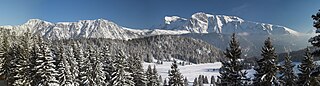
Magyar: Tájkép Bachat-Bouloud nevű faluból délkeleti irányba fényképezve, előtérben az l'Arselle-fennsíkkal. Háttérben a Taillefer-hegység látható a Grand Galbert, Pyramide és Taillefer csúcsokkal. A két hegyvonulat között a Romanche-folyó több mint 1000 méter mély völgye húzódik. (Belledonne-hegység, Alpok, Franciaország) |
| Date | |
| Source | Own work |
| Author | Tamás Mészöly |
| Permission (Reusing this file) |
Permission is granted for reuse under the terms of the Creative Commons licence specified below. The required attribution is: © 2006, Tamás Mészöly I would appreciate a message on my talk page if you plan to reuse this image outside of Wikimedia projects. |
| Camera location | | View this and other nearby images on: OpenStreetMap |
|---|
Licensing edit
I, the copyright holder of this work, hereby publish it under the following license:
This file is licensed under the Creative Commons Attribution-Share Alike 3.0 Unported license.
- You are free:
- to share – to copy, distribute and transmit the work
- to remix – to adapt the work
- Under the following conditions:
- attribution – You must give appropriate credit, provide a link to the license, and indicate if changes were made. You may do so in any reasonable manner, but not in any way that suggests the licensor endorses you or your use.
- share alike – If you remix, transform, or build upon the material, you must distribute your contributions under the same or compatible license as the original.
| Annotations | This image is annotated: View the annotations at Commons |
File history
Click on a date/time to view the file as it appeared at that time.
| Date/Time | Thumbnail | Dimensions | User | Comment | |
|---|---|---|---|---|---|
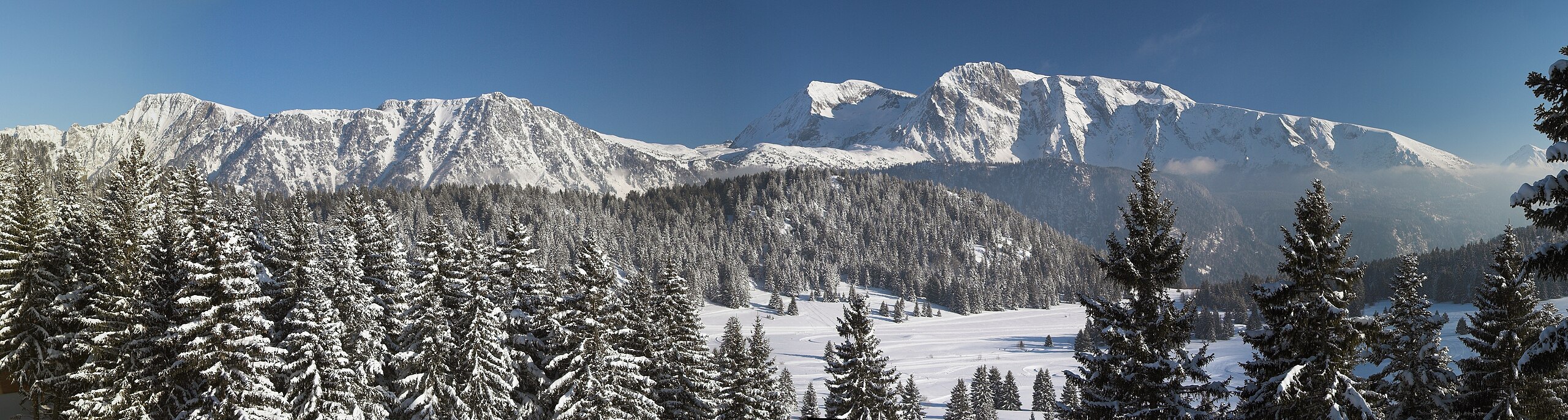
| current | 15:49, 11 August 2008 | 7,647 × 2,050 (6.94 MB) | Samat (talk | contribs) | {{Information |Description={{hu|1=Tájkép Chamrousse-ból, délkelet felé fényképezve. Belledonne-hegység, Alpok, Franciaország.}} |Source=Own work by uploader |Author=Samat |Date=2006. március |Permission=Permission is grant |
You cannot overwrite this file.
File usage on Commons
The following page uses this file:
File usage on other wikis
The following other wikis use this file:
- Usage on de.wikivoyage.org
- Usage on fr.wikipedia.org
- Usage on hu.wikipedia.org