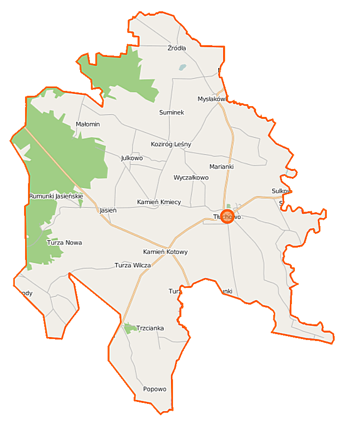
File:Tłuchowo (gmina) location map.png
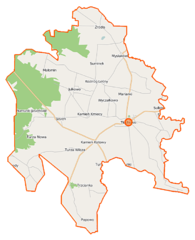
Size of this preview: 486 × 599 pixels. Other resolutions: 195 × 240 pixels | 389 × 480 pixels | 702 × 865 pixels.
Original file (702 × 865 pixels, file size: 73 KB, MIME type: image/png)
Captions
Captions
Add a one-line explanation of what this file represents
| Description |
Polski: Mapa gminy Tłuchowo, Polska
English: Map of Gmina Tłuchowo, Poland |
|||||||||
| Date | ||||||||||
| Source | You may find a page on the OpenStreetMap wiki page for Tłuchowo (gmina) | |||||||||
| Creator |
OpenStreetMap contributors OpenStreetMap contributors |
|||||||||
| Permission (Reusing this file) |
OpenStreetMap data is available under the Open Database License (details). Map tiles are licensed under the Creative Commons Attribution-ShareAlike 2.0 license (CC-BY-SA 2.0).
This file is licensed under the Creative Commons Attribution-Share Alike 2.0 Generic license.
|
|||||||||
| Geotemporal data | ||||||||||
| Bounding box |
|
|||||||||
| Georeferencing | If inappropriate please set warp_status = skip to hide. | |||||||||
File history
Click on a date/time to view the file as it appeared at that time.
| Date/Time | Thumbnail | Dimensions | User | Comment | |
|---|---|---|---|---|---|
| current | 20:38, 31 October 2014 | | 702 × 865 (73 KB) | VanWiel (talk | contribs) | {{OpenStreetMap | name = Tłuchowo (gmina) | location = Tłuchowo (gmina) | description = {{pl|Mapa gminy Tłuchowo, Polska}} {{en|Map of Gmina Tłuchowo, Poland}} | top = 52.8202 | left = 19.3404... |
You cannot overwrite this file.
File usage on Commons
There are no pages that use this file.
File usage on other wikis
The following other wikis use this file:
- Usage on de.wikipedia.org
- Usage on pl.wikipedia.org
- Tłuchowo
- Tłuchowo (gmina)
- Julkowo (województwo kujawsko-pomorskie)
- Kłobukowo
- Kamień Kmiecy
- Kamień Kotowy
- Koziróg Rzeczny
- Koziróg Leśny
- Małomin
- Mysłakowo
- Mysłakówko
- Turza Nowa
- Rumunki Jasieńskie
- Suminek (województwo kujawsko-pomorskie)
- Tłuchówek
- Turza Wilcza
- Wyczałkowo
- Jasień (województwo kujawsko-pomorskie)
- Trzcianka (powiat lipnowski)
- Źródła (województwo kujawsko-pomorskie)
- Borowo (powiat lipnowski)
- Marianki (powiat lipnowski)
- Michałkowo (gmina Tłuchowo)
- Podole (powiat lipnowski)
- Popowo (gmina Tłuchowo)
- Jeżewo (Tłuchowo)
- Parafia Wniebowzięcia Najświętszej Maryi Panny w Tłuchowie
- Moduł:Mapa/dane/Tłuchowo (gmina)
- Usage on pl.wikibooks.org
_location_map.png&oldid=505253010)