File:TWA flight 800 reconstruction by the National Transportation Safety Board was used as a training aid for about 20 years until 2021 at the NTSB’s Training Center in Ashburn, Virginia 12.jpg

Size of this preview: 800 × 533 pixels. Other resolutions: 320 × 213 pixels | 640 × 427 pixels | 1,024 × 683 pixels | 1,280 × 853 pixels | 2,560 × 1,707 pixels | 6,000 × 4,000 pixels.
Original file (6,000 × 4,000 pixels, file size: 6.51 MB, MIME type: image/jpeg)
Captions
Captions
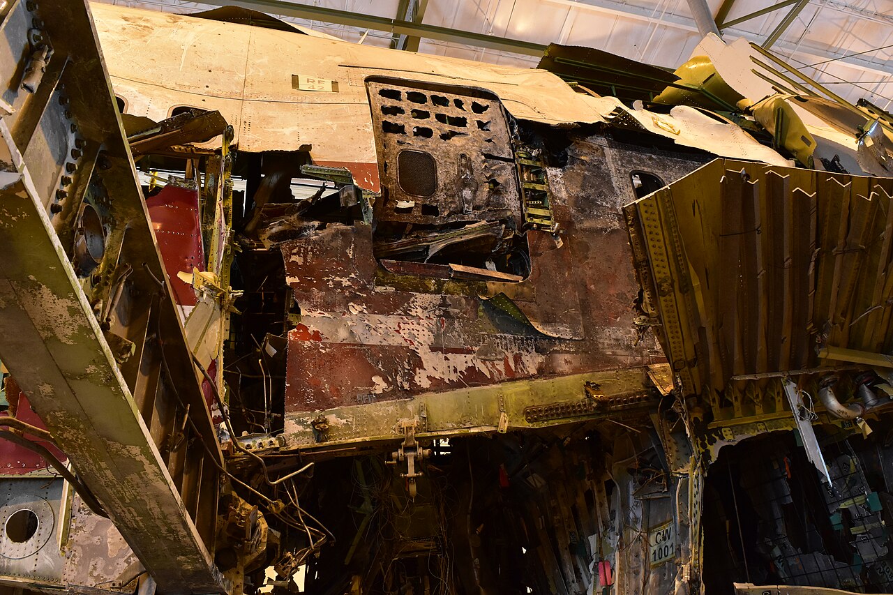
TWA flight 800 reconstruction by the National Transportation Safety Board was used as a training aid for about 20 years until 2021 at the NTSB’s Training Center in Ashburn, Virginia
Summary edit
| Description |
English: WASHINGTON (July 6, 2021) — The National Transportation Safety Board will cease using the TWA flight 800 reconstruction, (shown here) as a training aid July 7, 2021. Housed in a 30,000 square foot hangar at the National Transportation Safety Board’s Training Center in Ashburn, Virginia, decommissioning of the reconstruction is forecasted to begin in the fall of 2021. The reconstruction is being decommissioned as the NTSB determined continued use of the reconstruction as a training tool is no longer necessary and leasing space to accommodate it is no longer sustainable. The NTSB plans to award a contract to create a virtual, 3-D model of the reconstruction using JavaScript Object Notation. The reconstruction has been used for nearly 20 years to help train thousands of investigators, across all modes of the transportation industry, and other responders who have trained at the NTSB Training Center. Read more at go.usa.gov/xsWsA. (NTSB Photo by Chris O’Neil) |
| Date | |
| Source | https://www.flickr.com/photos/68618467@N03/51285768143/ |
| Author | NTSBgov |
Licensing edit
| This image was originally posted to Flickr by NTSBgov at https://flickr.com/photos/68618467@N03/51285768143. It was reviewed on 19 October 2023 by FlickreviewR 2 and was confirmed to be licensed under the terms of the Public Domain Mark. |
This image is a work of a National Transportation Safety Board employee, taken or made as part of an employee's official duties. As a work of the U.S. federal government, all NTSB images are in the public domain in the United States.
|
File history
Click on a date/time to view the file as it appeared at that time.
| Date/Time | Thumbnail | Dimensions | User | Comment | |
|---|---|---|---|---|---|
| current | 19:13, 19 October 2023 | | 6,000 × 4,000 (6.51 MB) | Ooligan (talk | contribs) | Uploaded a work by NTSBgov from https://www.flickr.com/photos/68618467@N03/51285768143/ with UploadWizard |
You cannot overwrite this file.
File usage on Commons
There are no pages that use this file.