File:Taažâ kárttá (2013) smn.svg

Size of this PNG preview of this SVG file: 250 × 251 pixels. Other resolutions: 239 × 240 pixels | 478 × 480 pixels | 765 × 768 pixels | 1,020 × 1,024 pixels | 2,040 × 2,048 pixels.
Original file (SVG file, nominally 250 × 251 pixels, file size: 1.12 MB)
Captions
Captions
Add a one-line explanation of what this file represents
Summary edit
| Description |
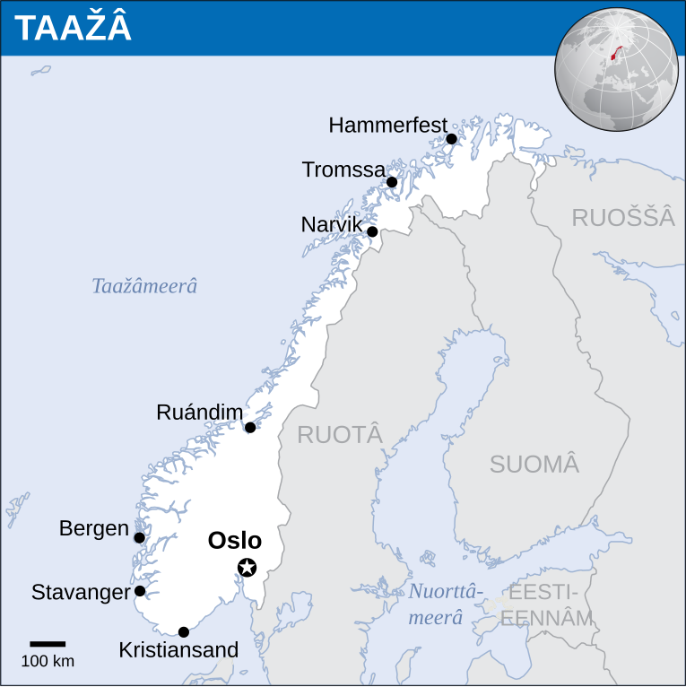
Anarâškielâ: Taažâ kárttá (OCHA ráhtám kárttá vuáđuld) English: Map of Norway based on OCHA map |
| Date | |
| Source | File:Norway_-_Location_Map_(2013)_-_NOR_-_UNOCHA.svg |
| Author |
English: UN Office for the Coordination of Humanitarian Affairs (OCHA), translated into Inari Sámi by Kimberli Mäkäräinen |
| Other versions |
|
_-_NOR_-_UNOCHA.svg)
_smn.svg)
_smn.svg&action=edit§ion=1)
Licensing edit
_smn.svg&action=edit§ion=2)
This file is licensed under the Creative Commons Attribution 3.0 Unported license.
- You are free:
- to share – to copy, distribute and transmit the work
- to remix – to adapt the work
- Under the following conditions:
- attribution – You must give appropriate credit, provide a link to the license, and indicate if changes were made. You may do so in any reasonable manner, but not in any way that suggests the licensor endorses you or your use.
File history
Click on a date/time to view the file as it appeared at that time.
| Date/Time | Thumbnail | Dimensions | User | Comment | |
|---|---|---|---|---|---|
| current | 12:14, 28 February 2024 | | 250 × 251 (1.12 MB) | Yupik (talk | contribs) | Uploaded a work by {{en|1=UN Office for the Coordination of Humanitarian Affairs (OCHA), translated into Inari Sámi by Kimberli Mäkäräinen}} from https://commons.wikimedia.org/wiki/File:Norway_-_Location_Map_(2013)_-_NOR_-_UNOCHA.svg with UploadWizard |
You cannot overwrite this file.
File usage on Commons
The following page uses this file:
File usage on other wikis
The following other wikis use this file:
- Usage on smn.wikipedia.org
_smn.svg&oldid=856543551)