File:Tantallon Castle plan 1950.jpg
Size of this preview: 800 × 493 pixels. Other resolutions: 320 × 197 pixels | 640 × 395 pixels | 1,024 × 632 pixels | 1,280 × 790 pixels | 2,560 × 1,579 pixels | 5,460 × 3,368 pixels.
Original file (5,460 × 3,368 pixels, file size: 1.19 MB, MIME type: image/jpeg)
Captions
Captions
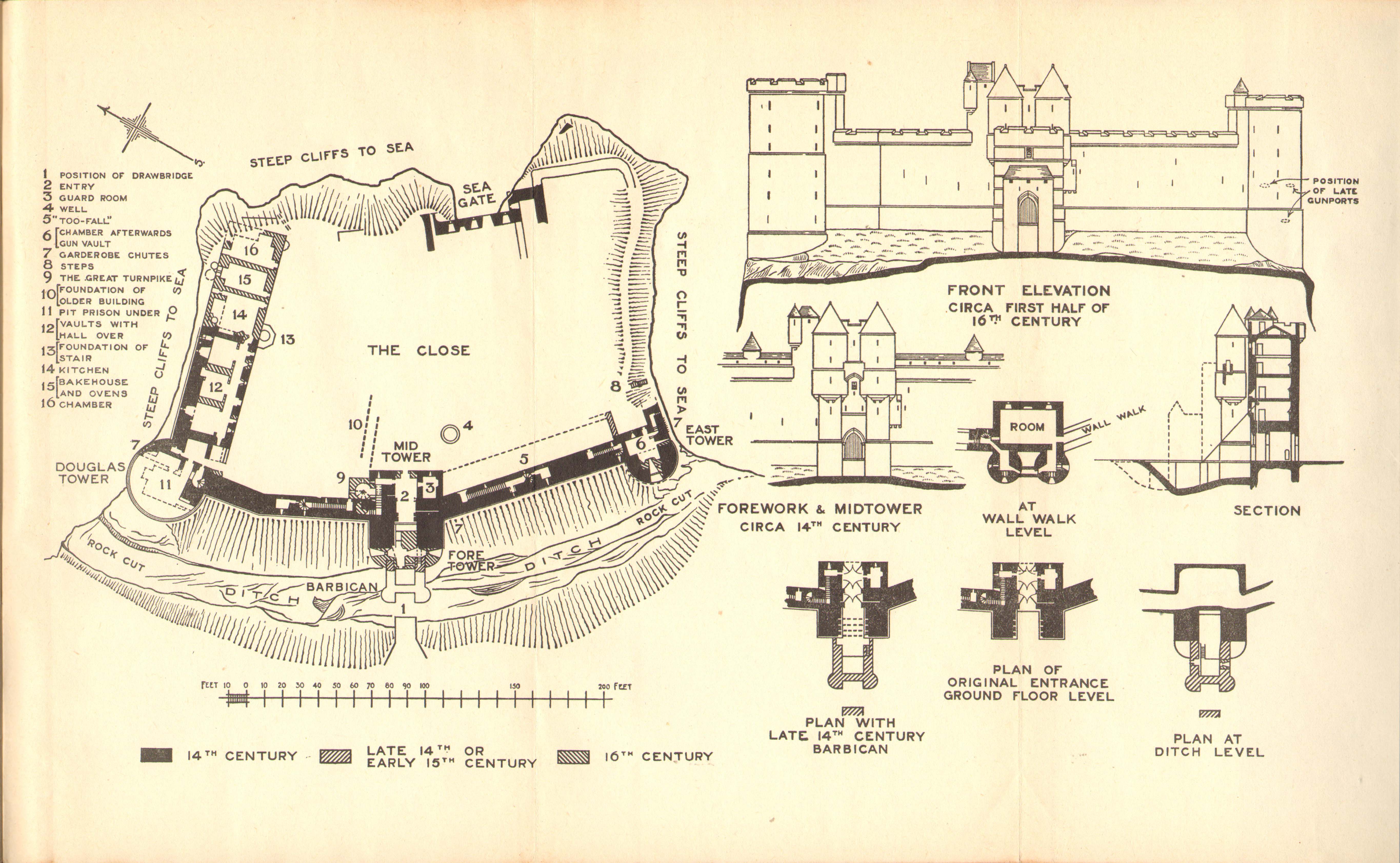
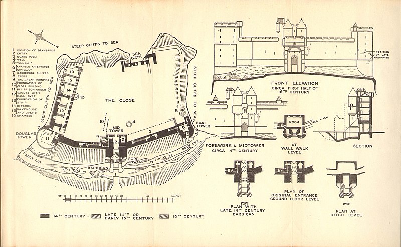
Plan and elevation of Tantallon Castle.
Summary edit
| Description |
English: Plan and elevation of Tantallon Castle, East Lothian. From The official guide-book published by HMSO, Full text of the second edition (1950) available at the Internet Archive |
| Date | |
| Source | Scan of original book |
| Author | J.S. Richardson |
Licensing edit
This work created by the United Kingdom Government is in the public domain.
This is because it is one of the following:
HMSO has declared that the expiry of Crown Copyrights applies worldwide (ref: HMSO Email Reply)
|
 |
File history
Click on a date/time to view the file as it appeared at that time.
| Date/Time | Thumbnail | Dimensions | User | Comment | |
|---|---|---|---|---|---|
| current | 22:24, 4 October 2019 | | 5,460 × 3,368 (1.19 MB) | Kognos (talk | contribs) | User created page with UploadWizard |
You cannot overwrite this file.
File usage on Commons
There are no pages that use this file.
File usage on other wikis
The following other wikis use this file:
- Usage on en.wikipedia.org