File:Tateyama Kurobe Alpine Route, Map (Japanese).jpg
Size of this preview: 800 × 400 pixels. Other resolutions: 320 × 160 pixels | 640 × 320 pixels | 1,024 × 512 pixels | 1,280 × 640 pixels | 2,560 × 1,280 pixels | 4,989 × 2,494 pixels.
Original file (4,989 × 2,494 pixels, file size: 7.38 MB, MIME type: image/jpeg)
Captions
Captions
Add a one-line explanation of what this file represents
Summary edit
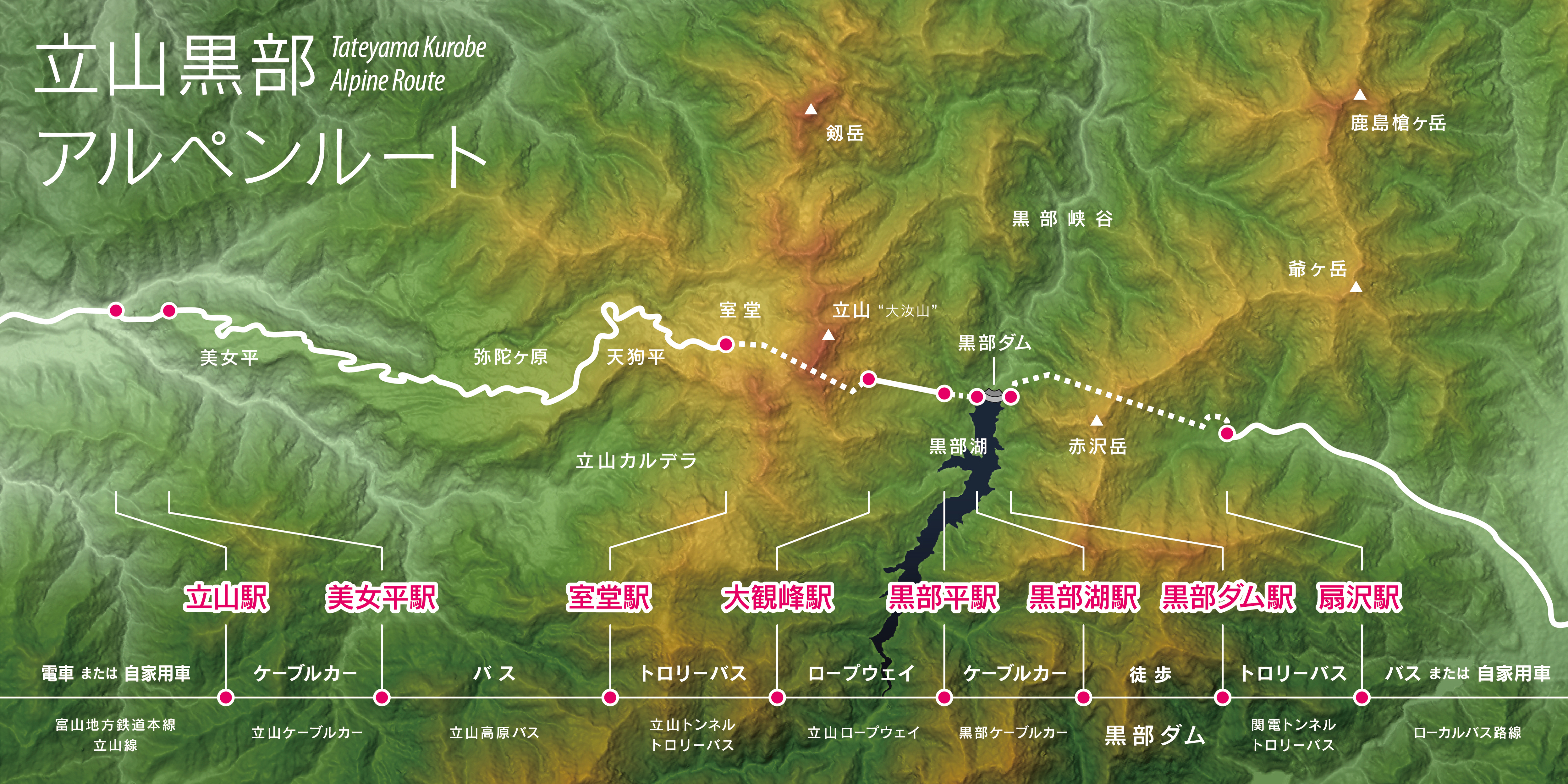
| Description | |
| Date | |
| Source |
Topographic data: NASA's SRTM-1 30m Mesh (ver.3 2014) |
| Author | Batholith |
| Other versions |
|
.jpg)
.jpg)
.jpg)
.jpg&action=edit§ion=1)
| Object location | | View this and other nearby images on: OpenStreetMap |
|---|
.jpg¶ms=036.566667_N_0137.633333_E_globe:Earth_class:object_type:object_region:JP_&language=en)
Licensing edit
.jpg&action=edit§ion=2)
| I, the copyright holder of this work, release this work into the public domain. This applies worldwide. In some countries this may not be legally possible; if so: I grant anyone the right to use this work for any purpose, without any conditions, unless such conditions are required by law. |
This image uses high-resolution digital topography data from NASA's Shuttle Radar Topography Mission (SRTM) at JPL-Caltech [1]. It is in the public domain in the United States.
|
 | |
File history
Click on a date/time to view the file as it appeared at that time.
| Date/Time | Thumbnail | Dimensions | User | Comment | |
|---|---|---|---|---|---|
| current | 12:13, 5 March 2016 | | 4,989 × 2,494 (7.38 MB) | Batholith (talk | contribs) | 文字位置、解像度 |
| 12:05, 5 March 2016 |  | 3,200 × 1,600 (3.43 MB) | Batholith (talk | contribs) | {{Information |Description= {{en|Map of Tateyama Kurobe Alpine Route, Chūbu region, Honshu, Japan. Data from "SRTM-1 (30m Mesh) Ver.3 2... |
You cannot overwrite this file.
File usage on Commons
The following 7 pages use this file:
- User:Batholith
- User:Batholith/Gallery 6
- Commons:WikiProject Aviation/recent uploads/2016 March 5
- File:Tateyama Kurobe Alpine Route, Map (English).jpg
- File:Tateyama Kurobe Alpine Route, Map (Universal).jpg
- File:Tateyama Kurobe Alpine Route, Map (Unmarked).jpg
- File:WV Tateyama Kurobe Alpine Route Banner.jpg
File usage on other wikis
The following other wikis use this file:
- Usage on en.wikipedia.org
- Usage on ja.wikipedia.org
.jpg&oldid=698503857)