File:Tatry-Czarny Staw.jpg

Original file (798 × 769 pixels, file size: 327 KB, MIME type: image/jpeg)
Captions
Captions
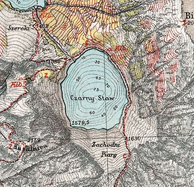
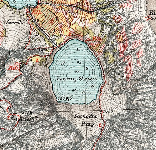
| Description | Czarny Staw. Fragment mapy "Tatry (część polska). Mapa fotogrametryczna" w skali 1:20.000 z 1938 r. | ||||
| Date | Before World War II/2007 | ||||
| Source | Wojskowy Instytut Geograficzny | ||||
| Author | |||||
| Permission (Reusing this file) |
|
||||

File history
Click on a date/time to view the file as it appeared at that time.
| Date/Time | Thumbnail | Dimensions | User | Comment | |
|---|---|---|---|---|---|
| current | 21:57, 9 December 2009 | | 798 × 769 (327 KB) | Aotearoa (talk | contribs) | {{Information |Description=Czarny Staw. Fragment mapy "Tatry (część polska). Mapa fotogrametryczna" z 1938 r. |Source=Wojskowy Instytut Geograficzny |Date=Before World War II/2007 |Author=Wojskowy Instytut Geograficzny |Permission={{PD-old}} |other_v |
You cannot overwrite this file.
File usage on Commons
There are no pages that use this file.
File usage on other wikis
The following other wikis use this file:
- Usage on pl.wikipedia.org