File:Tectonic plates boundaries physical World map Wt 180degE centered-en.svg

Size of this PNG preview of this SVG file: 800 × 489 pixels. Other resolutions: 320 × 196 pixels | 640 × 391 pixels | 1,024 × 626 pixels | 1,280 × 782 pixels | 2,560 × 1,564 pixels | 4,903 × 2,996 pixels.
Original file (SVG file, nominally 4,903 × 2,996 pixels, file size: 6.77 MB)
Captions
Captions
Add a one-line explanation of what this file represents
Summary
edit| Description |
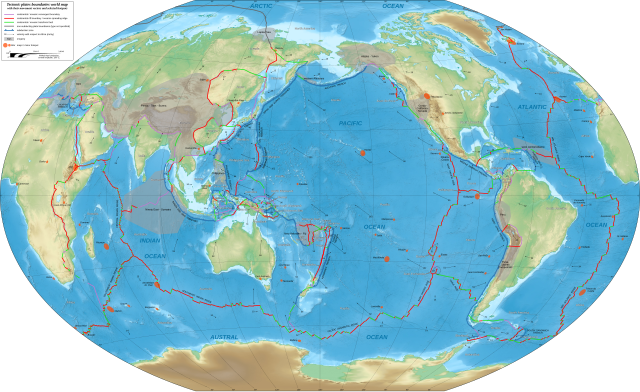
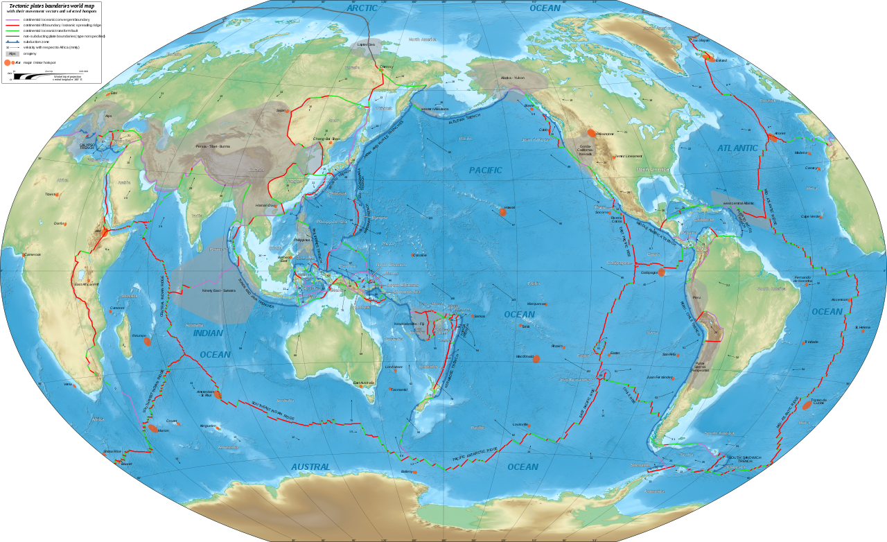
English: Physical world map in English showing the tectonic plates boundaries with their movement vectors and selected hotspots.
Français : Carte physique mondiale en anglais des limites des plaques tectoniques avec leurs vecteurs de déplacement et une sélection de hotspots.
Español: Mapa en inglés que muestra las placas tectónicas con sus vectores de movimiento.
Winkel tripel projection; central longitude: 180° E |
||
| Date | |||
| Source |
|
||
| Author | Eric Gaba (Sting - fr:Sting) | ||
| Permission (Reusing this file) |
|
||
| Other versions |
[]
|


|
This SVG file contains embedded text that can be translated into your language, using any capable SVG editor, text editor or the SVG Translate tool. For more information see: About translating SVG files. |
Licensing
edit
This file is licensed under the Creative Commons Attribution-Share Alike 3.0 Unported license.
Attribution: "Eric Gaba for Wikimedia Commons"
- You are free:
- to share – to copy, distribute and transmit the work
- to remix – to adapt the work
- Under the following conditions:
- attribution – You must give appropriate credit, provide a link to the license, and indicate if changes were made. You may do so in any reasonable manner, but not in any way that suggests the licensor endorses you or your use.
- share alike – If you remix, transform, or build upon the material, you must distribute your contributions under the same or compatible license as the original.
File history
Click on a date/time to view the file as it appeared at that time.
| Date/Time | Thumbnail | Dimensions | User | Comment | |
|---|---|---|---|---|---|
| current | 20:36, 16 February 2018 | | 4,903 × 2,996 (6.77 MB) | Sting (talk | contribs) | {{Information |Description={{en|Physical world map in English showing the tectonic plates boundaries with their movement vectors and selected hotspots.}} {{fr|Carte physique mondiale en anglais des limites des plaques tectoniques avec leurs vecteurs de... |
You cannot overwrite this file.
File usage on Commons
The following 12 pages use this file:
- User:Sting/Gallery: Maps of the world, of seas and about history
- File:Tectonic plates boundaries World map Wt 10degE centered-en.svg
- File:Tectonic plates boundaries World map Wt 10degE centered-fr.svg
- File:Tectonic plates boundaries World map Wt 180degE centered-en.svg
- File:Tectonic plates boundaries World map Wt 180degE centered-fr.svg
- File:Tectonic plates boundaries World map Wt 180degE centered-mk.svg
- File:Tectonic plates boundaries detailed-en.svg
- File:Tectonic plates boundaries physical World map Wt 10degE centered-en.svg
- File:Tectonic plates boundaries physical World map Wt 10degE centered-fr.svg
- File:Tectonic plates boundaries physical World map Wt 180degE centered-en.svg
- File:Tectonic plates boundaries physical World map Wt 180degE centered-fr.svg
- Template:Other versions/Tectonic plates boundaries World map Winkel tripel projection
File usage on other wikis
The following other wikis use this file:
- Usage on de.wikipedia.org
- Usage on en.wikipedia.org
- Usage on en.wikibooks.org
- Usage on eu.wikipedia.org
- Usage on id.wikipedia.org
- Usage on ja.wikipedia.org