File:Territoire de Cheikh Saïd.jpg
Size of this preview: 701 × 600 pixels. Other resolutions: 281 × 240 pixels | 561 × 480 pixels | 898 × 768 pixels | 1,197 × 1,024 pixels | 1,569 × 1,342 pixels.
Original file (1,569 × 1,342 pixels, file size: 873 KB, MIME type: image/jpeg)
Captions
Captions
Add a one-line explanation of what this file represents
Summary edit
| Description |
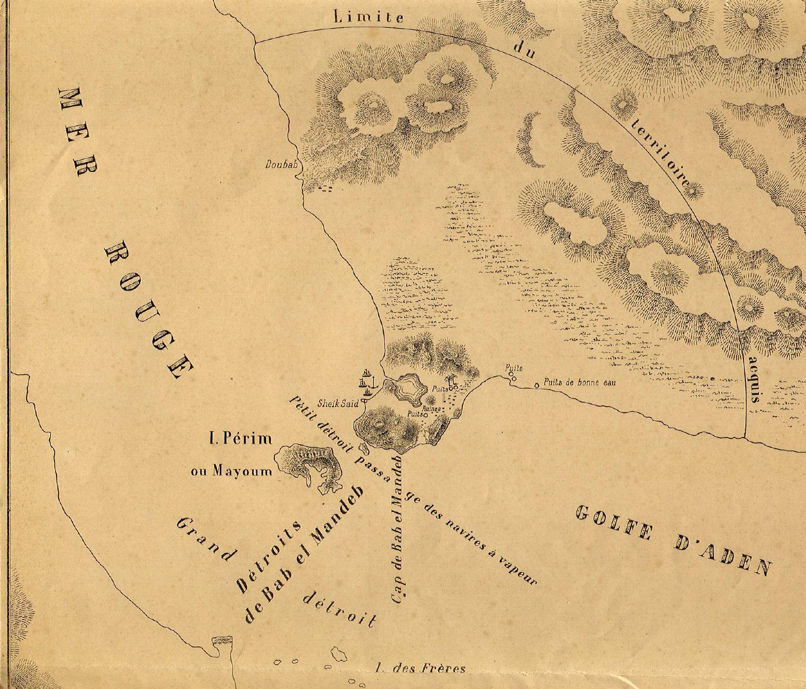
Français : Carte du Territoire de Cheikh Said. Cette carte accompagnait peut être le prospectus de la Société d'étude du Territoire de Bab-el-Mandeb (fondée en 1868), rapidement connu sous le nom de Territoire de Cheikh Saïd (ou Cheik-Saïd). English: Map of the Territory of Cheikh Said. This map may have been included in the prospectus of the Société d'étude du Territoire de Bab el-Mandeb (founded in 1868) better known as the Territoire de Cheikh Saïd (spelled Sheikh Said or Sheikh Syed in English) |
| Date | circa 1868 |
| Source | http://genealogie.centraliens.net/doc-rencontres/vdbroek.pdf |
| Author | Unknown, dated probably 1868 or 1869. |
Licensing edit
|
This work is in the public domain in its country of origin and other countries and areas where the copyright term is the author's life plus 100 years or fewer. | |
| This file has been identified as being free of known restrictions under copyright law, including all related and neighboring rights. | |
File history
Click on a date/time to view the file as it appeared at that time.
| Date/Time | Thumbnail | Dimensions | User | Comment | |
|---|---|---|---|---|---|
| current | 00:04, 27 September 2015 | | 1,569 × 1,342 (873 KB) | Lubiesque (talk | contribs) | User created page with UploadWizard |
You cannot overwrite this file.
File usage on Commons
There are no pages that use this file.
File usage on other wikis
The following other wikis use this file:
- Usage on fr.wikipedia.org
- Usage on ja.wikipedia.org
- Usage on ru.wikipedia.org