File:Teuri Island Aerial photograph.1977.jpg
Size of this preview: 800 × 577 pixels. Other resolutions: 320 × 231 pixels | 640 × 462 pixels | 1,024 × 739 pixels | 1,280 × 924 pixels | 2,560 × 1,848 pixels | 5,756 × 4,155 pixels.
Original file (5,756 × 4,155 pixels, file size: 11.16 MB, MIME type: image/jpeg)
Captions
Captions
Add a one-line explanation of what this file represents
Summary edit
| Description |
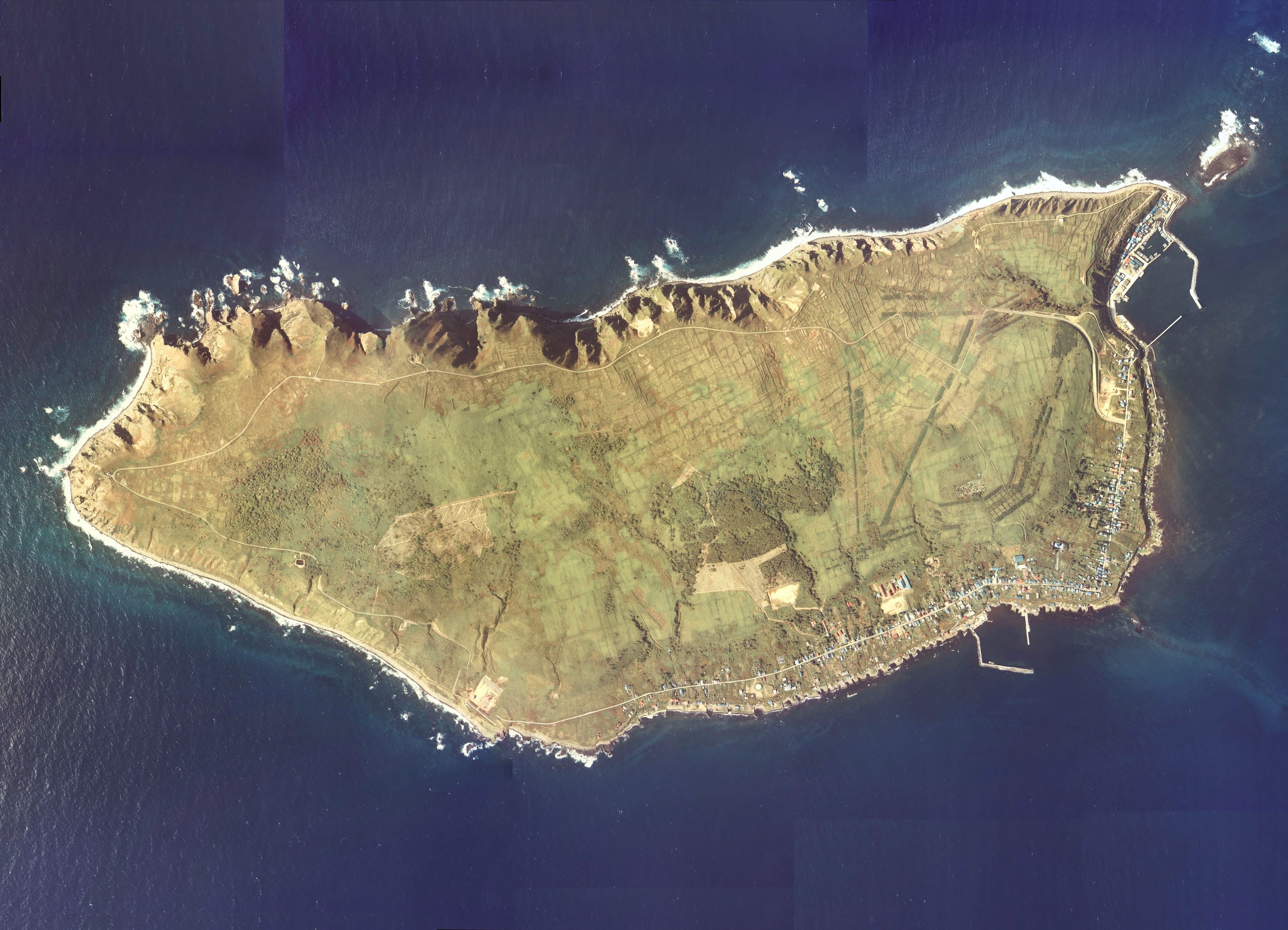
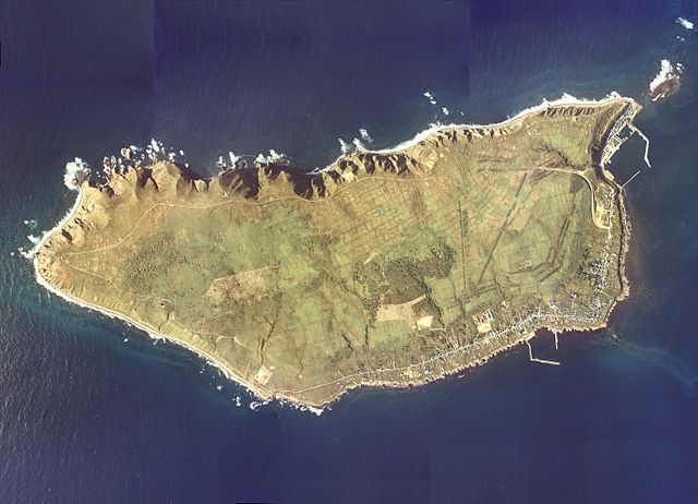
English: Teuri Island Aerial photograph.1977
日本語: 天売島(北海道羽幌町)の空中写真。Cho-77-55_c20の1,2,3,4,5、合計5枚を合成作成。 |
| Date | |
| Source | 国土情報ウェブマッピングシステム |
| Author | 国土交通省 |
Licensing edit

|
The copyright holder of this file, the Ministry of Land, Infrastructure, Transport and Tourism of Japan, allows anyone to use it for any purpose, provided that the copyright holder is properly attributed. Redistribution, derivative work, commercial use, and all other use is permitted. |
Attribution:
Copyright © National Land Image Information (Color Aerial Photographs), Ministry of Land, Infrastructure, Transport and Tourism
|
 |
This image is copyrighted by the Ministry of Land, Infrastructure, Transport and Tourism of Japan. For terms of use, see the stipulation to use of National Land Information (in Japanese) and message from MLIT (in Japanese and English). When you display this image on an article, include the following phrase in the description: "Made based on National Land Image Information (Color Aerial Photographs), Ministry of Land, Infrastructure, Transport and Tourism".
|
File history
Click on a date/time to view the file as it appeared at that time.
| Date/Time | Thumbnail | Dimensions | User | Comment | |
|---|---|---|---|---|---|
| current | 07:10, 8 October 2013 | | 5,756 × 4,155 (11.16 MB) | さかおり (talk | contribs) | {{Information |Description ={{en|1=Teuri Island Aerial photograph.1977}} {{ja|1=天売島(北海道羽幌町)の空中写真。Cho-77-55_c20の1,2,3,4,5、合計5枚を合成作成。}} |Source =国土情報ウェブマッピングシス... |
You cannot overwrite this file.
File usage on Commons
The following page uses this file:
File usage on other wikis
The following other wikis use this file:
- Usage on de.wikipedia.org
- Usage on ja.wikipedia.org
- Usage on www.wikidata.org