File:The End - geograph.org.uk - 1155780.jpg
No higher resolution available.
The_End_-_geograph.org.uk_-_1155780.jpg (640 × 429 pixels, file size: 253 KB, MIME type: image/jpeg)
Captions
Captions
Add a one-line explanation of what this file represents
Summary edit
| Description |
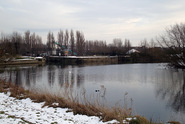
English: The End The point at which the River Calder (foreground) flows into the River Aire (running centre left to centre right). In the background can be seen the entrance to Castleford Junction lock and the short stretch of canal which bypasses the weir about 500 yards downstream of here. |
| Date | |
| Source | From geograph.org.uk |
| Author | David Pickersgill |
| Attribution (required by the license) | David Pickersgill / The End / |
| Camera location | | View this and other nearby images on: OpenStreetMap |
|---|
_heading:135.00&language=en)
| Object location | | View this and other nearby images on: OpenStreetMap |
|---|
_heading:135.00&language=en)
Licensing edit

|
This image was taken from the Geograph project collection. See this photograph's page on the Geograph website for the photographer's contact details. The copyright on this image is owned by David Pickersgill and is licensed for reuse under the Creative Commons Attribution-ShareAlike 2.0 license.
|
This file is licensed under the Creative Commons Attribution-Share Alike 2.0 Generic license.
Attribution: David Pickersgill
- You are free:
- to share – to copy, distribute and transmit the work
- to remix – to adapt the work
- Under the following conditions:
- attribution – You must give appropriate credit, provide a link to the license, and indicate if changes were made. You may do so in any reasonable manner, but not in any way that suggests the licensor endorses you or your use.
- share alike – If you remix, transform, or build upon the material, you must distribute your contributions under the same or compatible license as the original.
File history
Click on a date/time to view the file as it appeared at that time.
| Date/Time | Thumbnail | Dimensions | User | Comment | |
|---|---|---|---|---|---|
| current | 11:41, 25 February 2011 | | 640 × 429 (253 KB) | GeographBot (talk | contribs) | == {{int:filedesc}} == {{Information |description={{en|1=The End The point at which the River Calder (foreground) flows into the River Aire (running centre left to centre right). In the background can be seen the entrance to Castleford Junction lock and t |
You cannot overwrite this file.
File usage on Commons
There are no pages that use this file.