File:The Streets of Zante.jpg

Size of this preview: 800 × 600 pixels. Other resolutions: 320 × 240 pixels | 640 × 480 pixels | 1,024 × 768 pixels | 1,280 × 960 pixels | 2,560 × 1,920 pixels | 3,648 × 2,736 pixels.
Original file (3,648 × 2,736 pixels, file size: 1.26 MB, MIME type: image/jpeg)
Captions
Captions
Add a one-line explanation of what this file represents
Summary edit
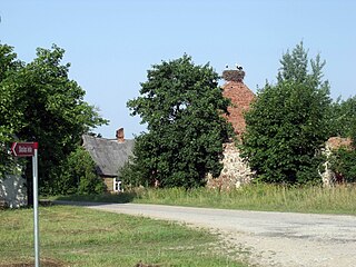
| Description | The Streets of Zante |
| Source | The Streets of Zante |
| Author | Tevfik Teker |
| Camera location | | View this and other nearby images on: OpenStreetMap |
|---|
Licensing edit
This file is licensed under the Creative Commons Attribution 3.0 Unported license.
- You are free:
- to share – to copy, distribute and transmit the work
- to remix – to adapt the work
- Under the following conditions:
- attribution – You must give appropriate credit, provide a link to the license, and indicate if changes were made. You may do so in any reasonable manner, but not in any way that suggests the licensor endorses you or your use.
| This image was originally posted to Panoramio by Tevfik Teker at https://www.panoramio.com/photo/38688317. It was reviewed on 31 July 2015 by the Panoramio Review Bot robot and was confirmed to be licensed under the terms of the cc-by-3.0. |
File history
Click on a date/time to view the file as it appeared at that time.
| Date/Time | Thumbnail | Dimensions | User | Comment | |
|---|---|---|---|---|---|
| current | 18:04, 30 July 2015 | | 3,648 × 2,736 (1.26 MB) | Kikos (talk | contribs) | {{Information |Description=The Streets of Zante |Source=[http://www.panoramio.com/photo/38688317 The Streets of Zante] |Date= |Author=[http://www.panoramio.com/user/745563 Tevfik Teker] |Permission= |other_versions= }} {{Location dec|56.837166|22.7314|... |
You cannot overwrite this file.
File usage on Commons
The following page uses this file:
File usage on other wikis
The following other wikis use this file: