File:The boundary between Oberpallen and Tontelange - Borne 121 - 2 - Bernard Piette.jpg
Size of this preview: 800 × 600 pixels. Other resolutions: 320 × 240 pixels | 640 × 480 pixels | 960 × 720 pixels.
Original file (960 × 720 pixels, file size: 139 KB, MIME type: image/jpeg)
Captions
Captions
Add a one-line explanation of what this file represents
Summary edit
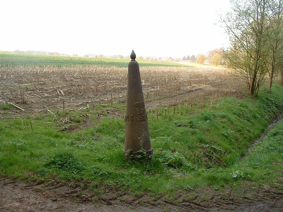
| Description |
English: The boundary between the Grand Duchy of Luxembourg ( Oberpallen ) and Belgium ( Tontelange ) - Registrations are : The date when the Boundary stone was placed, its number 121, the coat of arms of the Grand Duchy of Luxembourg and that of Belgium
Français : La borne frontière entre le Grand-Duché de Luxembourg ( Oberpallen ) et la Belgique ( Tontelange ) - Les inscriptions sont : La date où la borne a été placée, son numéro 121, les armoiries du Grand-Duché de Luxembourg et celui de la Belgique |
|||
| Date | ||||
| Source | Own work | |||
| Author | Bernard Piette | |||
| Permission (Reusing this file) |
|
|||
| Other versions |
 |


| Camera location | | View this and other nearby images on: OpenStreetMap |
|---|
File history
Click on a date/time to view the file as it appeared at that time.
| Date/Time | Thumbnail | Dimensions | User | Comment | |
|---|---|---|---|---|---|
| current | 08:23, 15 April 2009 | | 960 × 720 (139 KB) | Bernard Piette (talk | contribs) | {{Information |Description={{en|1=The boundary between the Grand Duchy of Luxembourg ( [http://fr.wikipedia.org/wiki/Oberpallen Oberpallen] ) and Belgium ( [http://fr.wikipedia.org/wiki/Tontelange Tontelange] ) - Registrations are : The date when the Bou |
You cannot overwrite this file.
File usage on Commons
The following 7 pages use this file:
- File:The boundary between Oberpallen and Tontelange - Borne 121 - 1 - Bernard Piette.jpg
- File:The boundary between Oberpallen and Tontelange - Borne 121 - 2 - Bernard Piette.jpg
- File:The boundary between Oberpallen and Tontelange - Borne 121 - 3 - Bernard Piette.jpg
- File:The boundary between Oberpallen and Tontelange - Borne 121 - 4 - Bernard Piette.jpg
- File:The boundary between Oberpallen and Tontelange - Borne 121 - 5 - Bernard Piette.jpg
- File:The boundary between Oberpallen and Tontelange - Borne 121 - 6 - Bernard Piette.jpg
- Category:Borders of Belgium-Luxembourg
File usage on other wikis
The following other wikis use this file:
- Usage on ca.wikipedia.org
- Usage on fr.wikipedia.org
- Usage on lb.wikipedia.org
- Usage on li.wikipedia.org
- Usage on nl.wikipedia.org
- Usage on wa.wikipedia.org
- Usage on www.wikidata.org