File:Thistle landslide.png

Size of this preview: 780 × 600 pixels. Other resolutions: 312 × 240 pixels | 624 × 480 pixels | 999 × 768 pixels | 1,280 × 985 pixels | 2,600 × 2,000 pixels.
Original file (2,600 × 2,000 pixels, file size: 794 KB, MIME type: image/png)
Captions
Captions
Add a one-line explanation of what this file represents
Summary edit
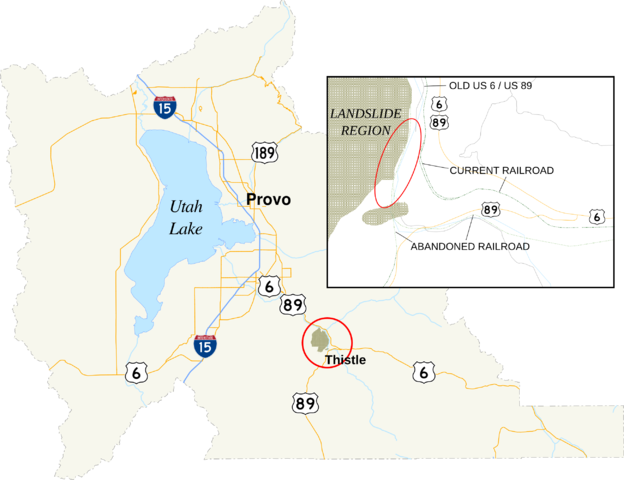
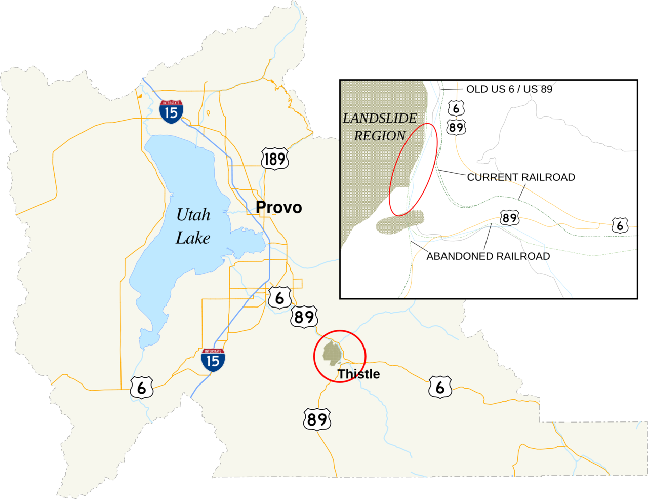
| Description | A map of Utah County, Utah, showing the location of Thistle in the county. In the map is an inset of the region affected by the 1983 landslide. The red circle denotes the area enlarged in the inset. The red oval is the approximate location of the landslide dam. |
| Date | |
| Source |
Utah State Geographic Information Database |
| Author | Fredddie. Created using Quantum GIS and inkscape, per standards set by the English language wikipedia's U.S. Roads Map Task Force. |
Licensing edit
This file is in the public domain because data provided by Utah State Geographic Information Database is considered to be in the public domain.[1]
|
File history
Click on a date/time to view the file as it appeared at that time.
| Date/Time | Thumbnail | Dimensions | User | Comment | |
|---|---|---|---|---|---|
| current | 05:25, 18 August 2010 | | 2,600 × 2,000 (794 KB) | Fredddie (talk | contribs) | {{Information |Description=A map of Utah County, Utah, showing the location of Thistle in the county. In the map is an inset of the region affected by the 1983 landslide. |Source={{own}} |Date=2010-08-18 |Author=Fredddie |Permission= |o |
You cannot overwrite this file.
File usage on Commons
There are no pages that use this file.
File usage on other wikis
The following other wikis use this file:
- Usage on en.wikipedia.org
- Usage on ja.wikipedia.org
- Usage on sco.wikipedia.org