File:ThreeKingdoms262.png

Size of this preview: 800 × 566 pixels. Other resolutions: 320 × 226 pixels | 640 × 453 pixels | 1,024 × 724 pixels | 1,280 × 905 pixels | 2,560 × 1,810 pixels | 21,047 × 14,882 pixels.
Original file (21,047 × 14,882 pixels, file size: 8.91 MB, MIME type: image/png)
Captions
Captions
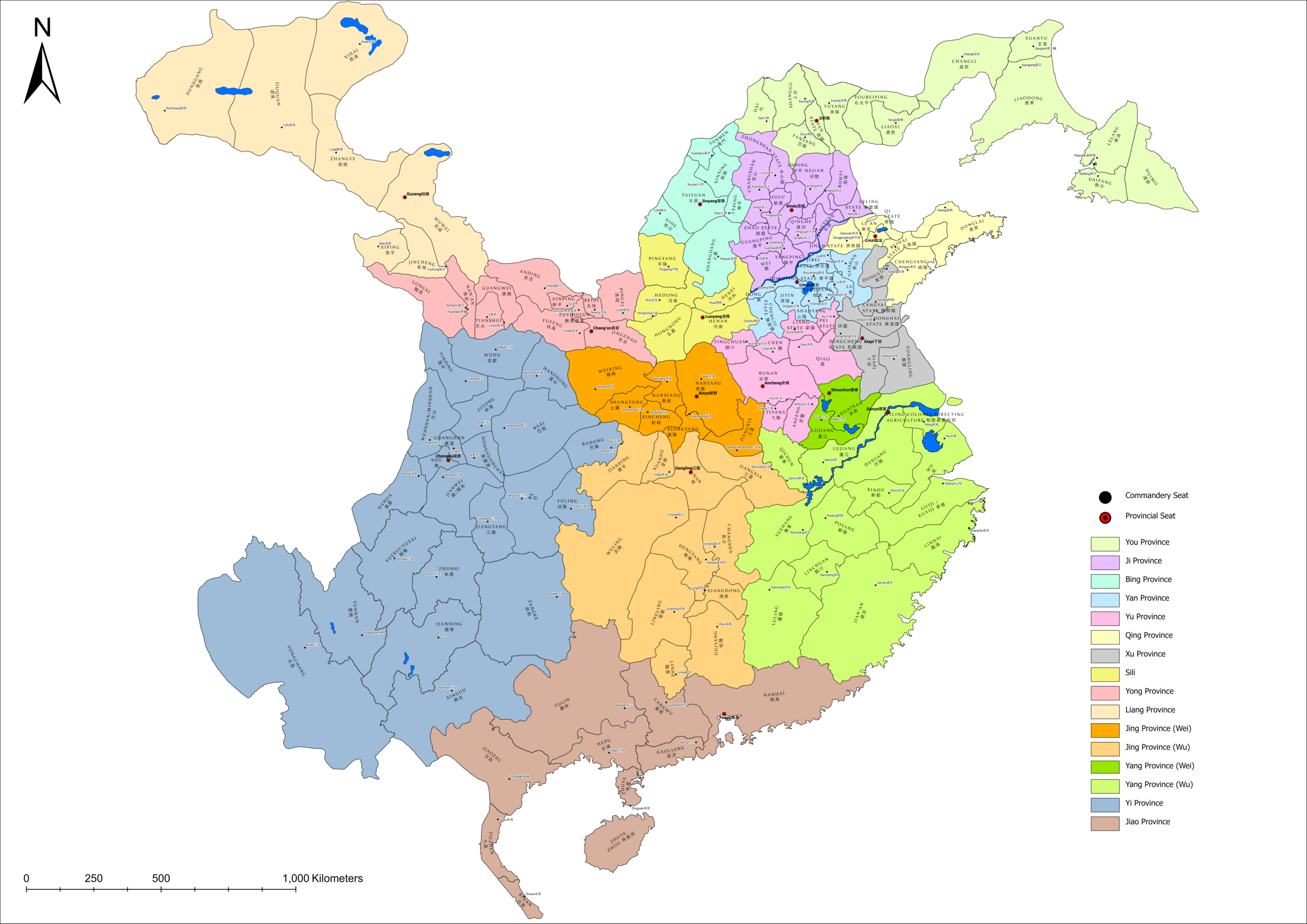
Map of the Three Kingdoms era in the 3rd year of Jingyuan (262)
Summary edit
| Description |
English: Map of the Three Kingdoms era containing the various commanderies and commandery seats. Commanderies are colour-coded by province.
中文:三国时期地图,标示了当时所有郡及郡治地点。属同一州的诸郡以同色标记。 |
| Date | |
| Source | Own work, based on data from The Historical Atlas of China; HydroSHEDS DEM |
| Author | Zhoudadudu |
Licensing edit
I, the copyright holder of this work, hereby publish it under the following license:
This file is licensed under the Creative Commons Attribution-Share Alike 4.0 International license.
- You are free:
- to share – to copy, distribute and transmit the work
- to remix – to adapt the work
- Under the following conditions:
- attribution – You must give appropriate credit, provide a link to the license, and indicate if changes were made. You may do so in any reasonable manner, but not in any way that suggests the licensor endorses you or your use.
- share alike – If you remix, transform, or build upon the material, you must distribute your contributions under the same or compatible license as the original.
File history
Click on a date/time to view the file as it appeared at that time.
| Date/Time | Thumbnail | Dimensions | User | Comment | |
|---|---|---|---|---|---|
| current | 02:20, 24 November 2023 | | 21,047 × 14,882 (8.91 MB) | Zhoudadudu (talk | contribs) | Uploaded own work with UploadWizard |
You cannot overwrite this file.
File usage on Commons
There are no pages that use this file.