File:Timperley metrolink station 1993.jpg
No higher resolution available.
Timperley_metrolink_station_1993.jpg (640 × 544 pixels, file size: 79 KB, MIME type: image/jpeg)
Captions
Captions
Add a one-line explanation of what this file represents
Summary edit
| Description |
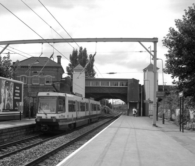
English: Timperley station All Metrolink stations were made fully accessible to disabled people. The neat appearance of the lifts can be seen to advantage here. |
| Date | |
| Source | From geograph.org.uk |
| Author | Dr Neil Clifton |
| Camera location | | View this and other nearby images on: OpenStreetMap |
|---|
Licensing edit

|
This image was taken from the Geograph project collection. See this photograph's page on the Geograph website for the photographer's contact details. The copyright on this image is owned by Dr Neil Clifton and is licensed for reuse under the Creative Commons Attribution-ShareAlike 2.0 license.
|
This file is licensed under the Creative Commons Attribution-Share Alike 2.0 Generic license.
Attribution: Dr Neil Clifton
- You are free:
- to share – to copy, distribute and transmit the work
- to remix – to adapt the work
- Under the following conditions:
- attribution – You must give appropriate credit, provide a link to the license, and indicate if changes were made. You may do so in any reasonable manner, but not in any way that suggests the licensor endorses you or your use.
- share alike – If you remix, transform, or build upon the material, you must distribute your contributions under the same or compatible license as the original.
File history
Click on a date/time to view the file as it appeared at that time.
| Date/Time | Thumbnail | Dimensions | User | Comment | |
|---|---|---|---|---|---|
| current | 23:06, 6 January 2009 | | 640 × 544 (79 KB) | Nev1 (talk | contribs) | {{Information |Description=Timperley metrolink station |Source=http://www.geograph.org.uk/photo/716488 |Date=23 August 1993 |Author=[http://www.geograph.org.uk/profile/796 Dr Neil Clifton] |Permission= |other_versions= }} == License information == {{Cc-b |
You cannot overwrite this file.
File usage on Commons
There are no pages that use this file.
File usage on other wikis
The following other wikis use this file:
- Usage on en.wikipedia.org