File:Tour de Timor 2012.png
Size of this preview: 800 × 489 pixels. Other resolutions: 320 × 196 pixels | 640 × 391 pixels | 1,024 × 626 pixels | 1,280 × 783 pixels | 2,000 × 1,223 pixels.
Original file (2,000 × 1,223 pixels, file size: 275 KB, MIME type: image/png)
Captions
Captions
Add a one-line explanation of what this file represents
| Description |
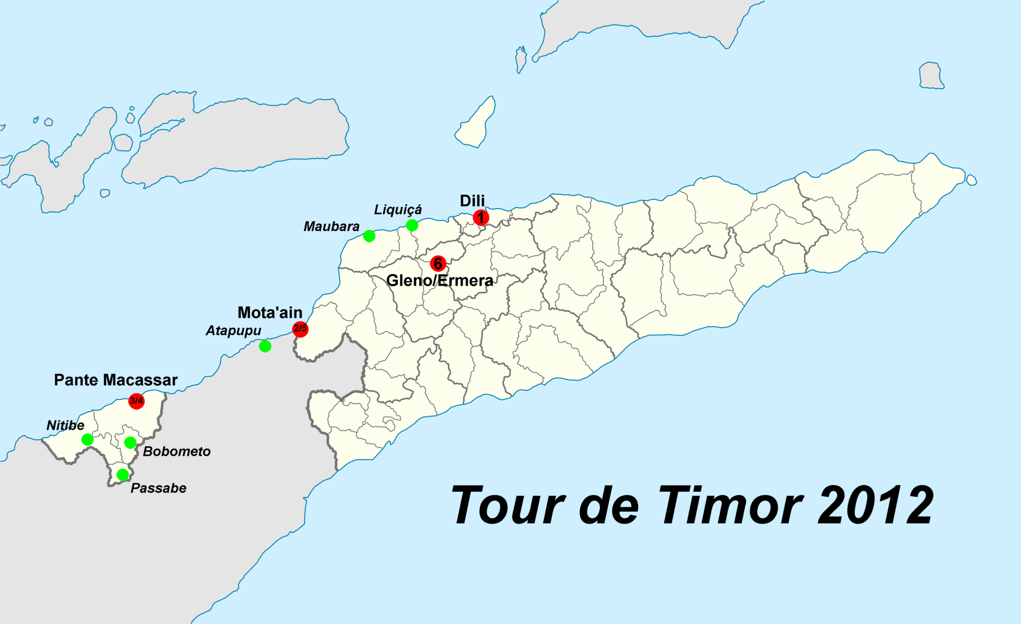
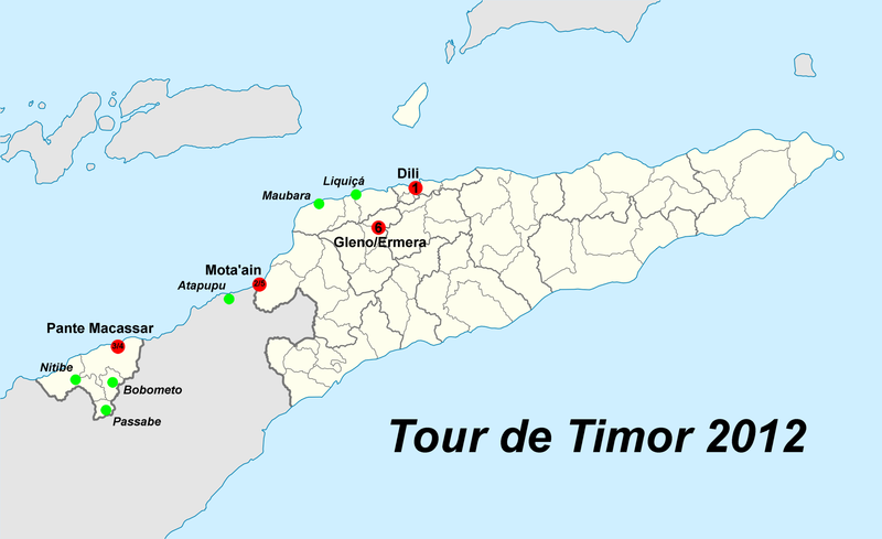
Deutsch: Etappenziele der Tour de Timor 2012 English: Stops of the Tour de Timor 2012 |
| Date | |
| Source | |
| Author |
|
| This is a retouched picture, which means that it has been digitally altered from its original version. Modifications: Cities added. The original can be viewed here: East Timor location map 2003-2015.svg:
|
I, the copyright holder of this work, hereby publish it under the following licenses:
This file is licensed under the Creative Commons Attribution 3.0 Unported license.
- You are free:
- to share – to copy, distribute and transmit the work
- to remix – to adapt the work
- Under the following conditions:
- attribution – You must give appropriate credit, provide a link to the license, and indicate if changes were made. You may do so in any reasonable manner, but not in any way that suggests the licensor endorses you or your use.

|
Permission is granted to copy, distribute and/or modify this document under the terms of the GNU Free Documentation License, Version 1.2 or any later version published by the Free Software Foundation; with no Invariant Sections, no Front-Cover Texts, and no Back-Cover Texts. A copy of the license is included in the section entitled GNU Free Documentation License. |
You may select the license of your choice.
Original upload log edit
This image is a derivative work of the following images:
- File:East_Timor_location_map.svg licensed with Cc-by-3.0, GFDL
- 2009-05-27T16:17:19Z NordNordWest 1701x1040 (205849 Bytes) completed
- 2009-05-25T16:19:05Z NordNordWest 1701x1040 (129300 Bytes) c
- 2009-05-25T16:11:04Z NordNordWest 1701x1040 (128635 Bytes) {{Information |Description= {{de|Positionskarte von [[:de:Osttimor|Osttimor]]}} Quadratische Plattkarte. Geographische Begrenzung der Karte: * N: 7.8° S * S: 10.0° S * W: 123.9° O * O: 127.5° O {{en|Location map of [[:en:
File history
Click on a date/time to view the file as it appeared at that time.
| Date/Time | Thumbnail | Dimensions | User | Comment | |
|---|---|---|---|---|---|
| current | 17:08, 27 May 2012 | | 2,000 × 1,223 (275 KB) | J. Patrick Fischer (talk | contribs) | {{Information |Description ={{de|1=our}} |Source ={{own}} |Author =J. Patrick Fischer |Date = |Permission = |other_versions = }} |
You cannot overwrite this file.
File usage on Commons
There are no pages that use this file.
File usage on other wikis
The following other wikis use this file:
- Usage on de.wikipedia.org
- Usage on en.wikipedia.org
- Usage on tet.wikipedia.org