File:Tourists at Fort San Lorenzo.png

Size of this preview: 800 × 537 pixels. Other resolutions: 320 × 215 pixels | 640 × 430 pixels | 1,024 × 687 pixels | 1,280 × 859 pixels | 1,776 × 1,192 pixels.
Original file (1,776 × 1,192 pixels, file size: 3.44 MB, MIME type: image/png)
Captions
Captions
Add a one-line explanation of what this file represents
Summary edit
| Description |
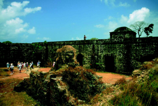
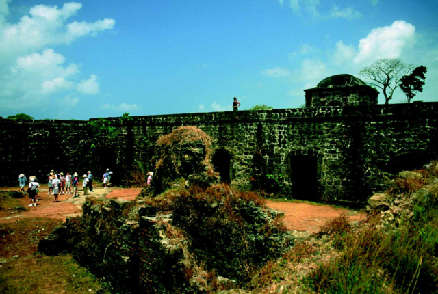
English: Situated on a promontory above the Chagres River, Fort San Lorenzo is among the most attractive of the many hiking, sightseeing, and bird watching areas in the San Lorenzo Protected Area. In addition to the historic ruins, several bird species may be seen on any day—among them terns, parakeets, flycatchers, elaenia, martins, swallows, and robins. |
| Date | |
| Source | Peter L. Weaver and Gerald P. Bauer. "The San Lorenzo Protected Area: A Summary of Cultural and Natural Resources". United States Department of Agriculture Forest Service, International Institute of Tropical Forestry. http://www.sanlorenzo.org.pa/docs/IITF_25r_03_30_04_ingles.pdf |
| Author | Gerald P. Bauer |
| Camera location | | View this and other nearby images on: OpenStreetMap |
|---|
Licensing edit
This image is a work of the Forest Service of the United States Department of Agriculture. As a work of the U.S. federal government, the image is in the public domain.
|
File history
Click on a date/time to view the file as it appeared at that time.
| Date/Time | Thumbnail | Dimensions | User | Comment | |
|---|---|---|---|---|---|
| current | 16:10, 3 November 2012 | | 1,776 × 1,192 (3.44 MB) | Matjamoe~commonswiki (talk | contribs) | User created page with UploadWizard |
You cannot overwrite this file.
File usage on Commons
There are no pages that use this file.
File usage on other wikis
The following other wikis use this file:
- Usage on en.wikipedia.org