File:Town of Logan, Logan Village, 19th Century.jpg

Size of this preview: 551 × 599 pixels. Other resolutions: 221 × 240 pixels | 442 × 480 pixels | 706 × 768 pixels | 942 × 1,024 pixels | 1,884 × 2,048 pixels | 4,480 × 4,870 pixels.
Original file (4,480 × 4,870 pixels, file size: 671 KB, MIME type: image/jpeg)
Captions
Captions
Add a one-line explanation of what this file represents
Summary edit
| Description |
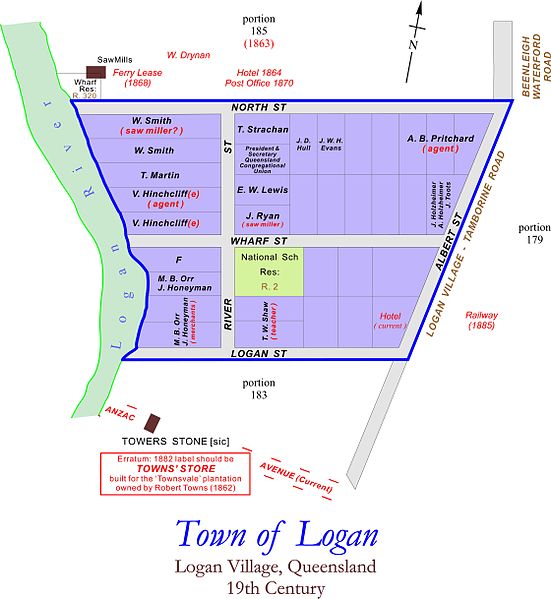
English: A map of the township at Logan Village, Queensland, Australia in the 19th Century. |
| Date | |
| Source | base map: Queensland State Archives Item ID 621952, Map, Town of Logan (1882) |
| Author | Brass razoo |
| Camera location | | View this and other nearby images on: OpenStreetMap |
|---|
Licensing edit
I, the copyright holder of this work, hereby publish it under the following license:
This file is licensed under the Creative Commons Attribution-Share Alike 3.0 Unported license.
- You are free:
- to share – to copy, distribute and transmit the work
- to remix – to adapt the work
- Under the following conditions:
- attribution – You must give appropriate credit, provide a link to the license, and indicate if changes were made. You may do so in any reasonable manner, but not in any way that suggests the licensor endorses you or your use.
- share alike – If you remix, transform, or build upon the material, you must distribute your contributions under the same or compatible license as the original.
File history
Click on a date/time to view the file as it appeared at that time.
| Date/Time | Thumbnail | Dimensions | User | Comment | |
|---|---|---|---|---|---|
| current | 02:11, 30 July 2013 | | 4,480 × 4,870 (671 KB) | Brass razoo (talk | contribs) | |
| 01:31, 30 July 2013 |  | 4,480 × 4,870 (673 KB) | Brass razoo (talk | contribs) | User created page with UploadWizard |
You cannot overwrite this file.
File usage on Commons
There are no pages that use this file.
File usage on other wikis
The following other wikis use this file:
- Usage on en.wikipedia.org