File:Toyosato in Shiga Prefecture Ja.svg

Original file (SVG file, nominally 390 × 610 pixels, file size: 10 KB)
Captions
Captions
Summary edit
| Description |
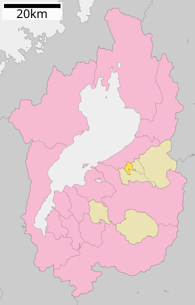
English: Location of Toyosato in Shiga Prefecture
|
||
| Date | 更新:2010年3月21日 | ||
| Source |
|
||
| Author | Lincun | ||
| Permission (Reusing this file) |
|
Licensing edit

|
Permission is granted to copy, distribute and/or modify this document under the terms of the GNU Free Documentation License, Version 1.2 or any later version published by the Free Software Foundation; with no Invariant Sections, no Front-Cover Texts, and no Back-Cover Texts. A copy of the license is included in the section entitled GNU Free Documentation License. |
- You are free:
- to share – to copy, distribute and transmit the work
- to remix – to adapt the work
- Under the following conditions:
- attribution – You must give appropriate credit, provide a link to the license, and indicate if changes were made. You may do so in any reasonable manner, but not in any way that suggests the licensor endorses you or your use.
- share alike – If you remix, transform, or build upon the material, you must distribute your contributions under the same or compatible license as the original.
Original upload log edit
| This file was moved from Japanese Wikipedia.
See below for original file information. | ||||||||||||||||||||||||||||||||||||||||||||||||||||
| ||||||||||||||||||||||||||||||||||||||||||||||||||||
|
| ||||||||||||||||||||||||||||||||||||||||||||||||||||
File history
Click on a date/time to view the file as it appeared at that time.
| Date/Time | Thumbnail | Dimensions | User | Comment | |
|---|---|---|---|---|---|
| current | 15:30, 29 December 2016 | | 390 × 610 (10 KB) | Kitayama (talk | contribs) | New version from ja:ファイル:基礎自治体位置図 25441.svg |
| 13:38, 22 March 2010 |  | 390 × 610 (10 KB) | Lincun (talk | contribs) | {{基礎自治体位置図画像情報|滋賀県|豊郷町|20100321}} | |
| 10:26, 10 January 2010 |  | 390 × 610 (9 KB) | Lincun (talk | contribs) | {{基礎自治体位置図画像情報|滋賀県|豊郷町|20100101}} | |
| 15:58, 22 October 2009 |  | 450 × 772 (13 KB) | Monaneko (talk | contribs) | {{Information |Description={{en|1=Location of Toyosato in Shiga Prefecture}} {{ja|1=滋賀県犬上郡豊郷町の位置}} |Source=ja:File:基礎自治体位置図 25441.svg |Author=ja:User:Lincun |Date=2007-10-08 12:53 (UTC) |Permission= |other | |
| 12:53, 8 October 2007 |  | 450 × 772 (13 KB) | Lincun (talk | contribs) | {{基礎自治体位置図画像情報|滋賀県|豊郷町}} |
You cannot overwrite this file.
File usage on Commons
The following 2 pages use this file:
- Maps of Shiga prefecture
- File:基礎自治体位置図 25441.svg (file redirect)
File usage on other wikis
The following other wikis use this file:
- Usage on en.wikipedia.org
- Usage on fa.wikipedia.org
- Usage on id.wikipedia.org
- Usage on it.wikipedia.org
- Usage on ja.wikipedia.org
- Usage on ko.wikipedia.org
- Usage on ms.wikipedia.org
- Usage on sv.wikipedia.org
- Usage on vi.wikipedia.org
- Usage on zh.wikipedia.org