File:Tramlijn Heerlen - Sittard op de landkaart.png

Size of this preview: 470 × 599 pixels. Other resolutions: 188 × 240 pixels | 377 × 480 pixels | 602 × 768 pixels | 1,071 × 1,365 pixels.
Original file (1,071 × 1,365 pixels, file size: 2.53 MB, MIME type: image/png)
Captions
Captions
Add a one-line explanation of what this file represents
Summary edit
| Description |
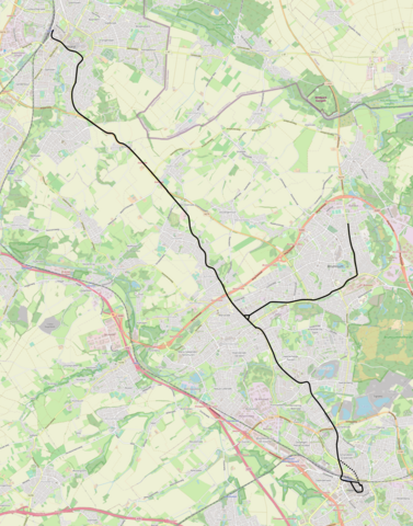
Nederlands: Tracé van de tramlijn Heerlen - Sittard/Brunssum. |
| Date | |
| Source | openstreetmap.org |
| Author | OpenStreetMap contributors |
| Permission (Reusing this file) |
All OpenStreetMap data and maps are Creative Commons "CC-BY-SA 2.0" licensed |
Licensing edit
This file is licensed under the Creative Commons Attribution-Share Alike 4.0 International license.
- You are free:
- to share – to copy, distribute and transmit the work
- to remix – to adapt the work
- Under the following conditions:
- attribution – You must give appropriate credit, provide a link to the license, and indicate if changes were made. You may do so in any reasonable manner, but not in any way that suggests the licensor endorses you or your use.
- share alike – If you remix, transform, or build upon the material, you must distribute your contributions under the same or compatible license as the original.
File history
Click on a date/time to view the file as it appeared at that time.
| Date/Time | Thumbnail | Dimensions | User | Comment | |
|---|---|---|---|---|---|
| current | 18:28, 16 April 2021 | | 1,071 × 1,365 (2.53 MB) | Vincenthendriks (talk | contribs) | + lus in de Heerlense binnenstad |
| 18:40, 15 April 2021 |  | 1,071 × 1,365 (2.53 MB) | Vincenthendriks (talk | contribs) | met het eindpunt Willemstraat Heerlen met stippellijn ingetekend | |
| 18:37, 15 April 2021 |  | 1,071 × 1,365 (2.53 MB) | Vincenthendriks (talk | contribs) | Uploaded a work by OpenStreetMap contributors from openstreetmap.org with UploadWizard |
You cannot overwrite this file.
File usage on Commons
The following 2 pages use this file:
File usage on other wikis
The following other wikis use this file:
- Usage on nl.wikipedia.org
- Usage on www.wikidata.org