File:Transkaspischer Oblast 1900-Fluchtroute-Uralkosaken-de.svg

Size of this PNG preview of this SVG file: 601 × 599 pixels. Other resolutions: 241 × 240 pixels | 482 × 480 pixels | 770 × 768 pixels | 1,027 × 1,024 pixels | 2,054 × 2,048 pixels | 639 × 637 pixels.
Original file (SVG file, nominally 639 × 637 pixels, file size: 94 KB)
Captions
Captions
Add a one-line explanation of what this file represents
Summary edit
| Description |
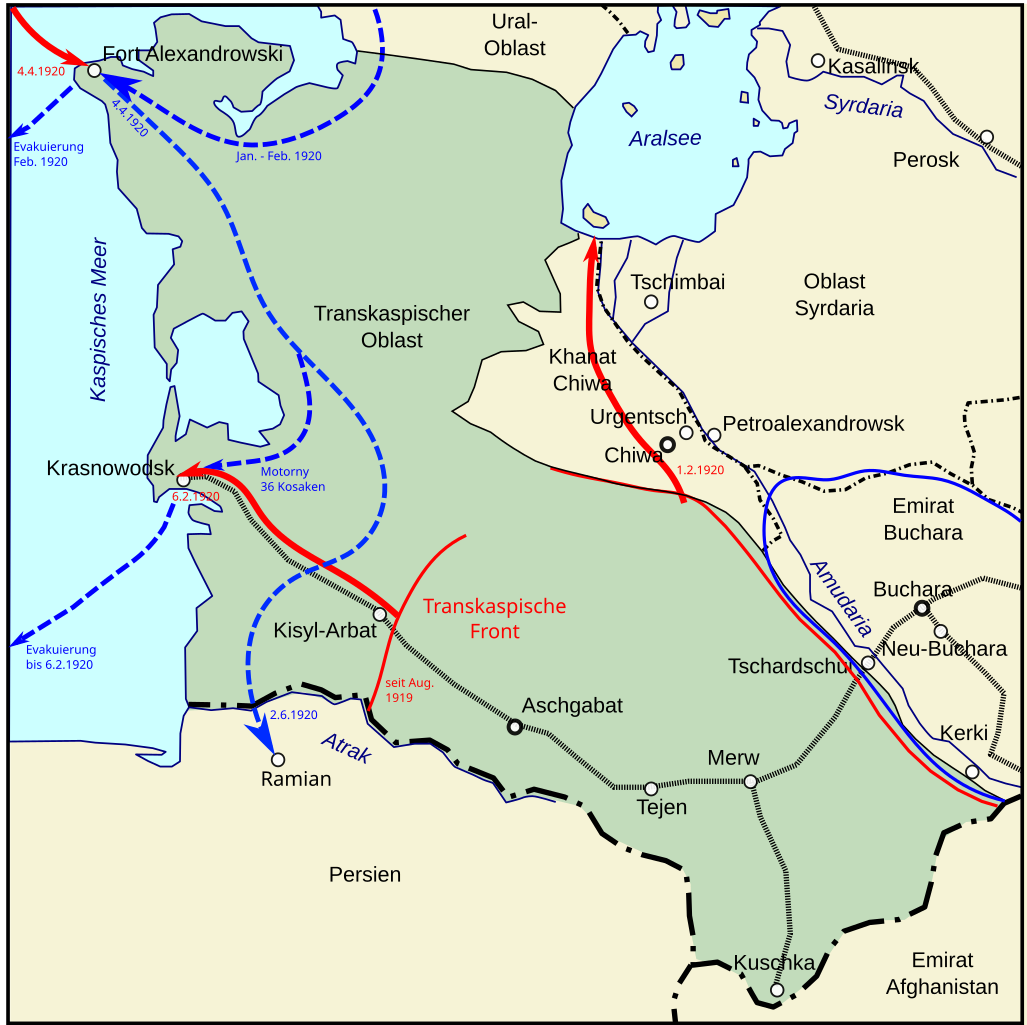
Deutsch: Karte des Transkaspischen Oblast des Russischen Kaiserreiches in den bis Ende 1920 gültigen Grenzen. In blauer Farbe ist die Fluchtroute der letzten Anghörigen des Ural-Kosakenheers nach Persien eingezeichnet. |
| Date | |
| Source |
 |
| Author | User:Wassily |
Licensing edit
This file is licensed under the Creative Commons Attribution-Share Alike 3.0 Unported license.
- You are free:
- to share – to copy, distribute and transmit the work
- to remix – to adapt the work
- Under the following conditions:
- attribution – You must give appropriate credit, provide a link to the license, and indicate if changes were made. You may do so in any reasonable manner, but not in any way that suggests the licensor endorses you or your use.
- share alike – If you remix, transform, or build upon the material, you must distribute your contributions under the same or compatible license as the original.
File history
Click on a date/time to view the file as it appeared at that time.
| Date/Time | Thumbnail | Dimensions | User | Comment | |
|---|---|---|---|---|---|
| current | 19:25, 18 October 2020 | | 639 × 637 (94 KB) | Kl833x9 (talk | contribs) | Ergänzung militärische Lage. |
| 12:06, 18 October 2020 |  | 600 × 639 (74 KB) | Kl833x9 (talk | contribs) | Uploaded a work by User:Wassily from File:Закаспийская область 1900.svg with UploadWizard |
You cannot overwrite this file.
File usage on Commons
There are no pages that use this file.
File usage on other wikis
The following other wikis use this file:
- Usage on de.wikipedia.org