File:Traversing the Horns of Alligin - geograph.org.uk - 1550119.jpg
No higher resolution available.
Traversing_the_Horns_of_Alligin_-_geograph.org.uk_-_1550119.jpg (640 × 435 pixels, file size: 80 KB, MIME type: image/jpeg)
Captions
Captions
Add a one-line explanation of what this file represents
Summary edit
| Description |
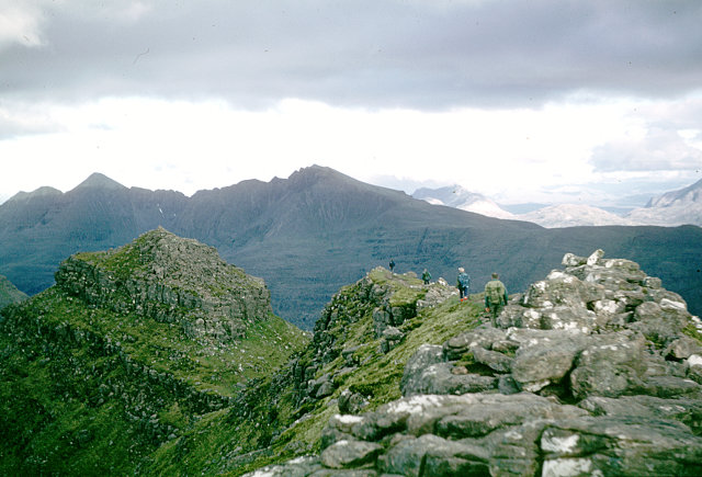
English: Traversing the Horns of Alligin Having just arrived from a week in Skye and not left the road until very late afternoon, reaching the top of Beinn Alligin after 7 p.m., I was surprised to meet other people on the ridge. That's what you get for doing Munros out of season, I suppose ! The traverse of the Horns is the only vaguely scrambly bit of Beinn Alligin, but it makes a fitting ending to the traverse of the ridge and certainly wasn't possible the next time I came here (also in summer), when we were forced off the ridge in a force eight. |
| Date | |
| Source | From geograph.org.uk |
| Author | Andy Waddington |
| Attribution (required by the license) | Andy Waddington / Traversing the Horns of Alligin / |
| Camera location | | View this and other nearby images on: OpenStreetMap |
|---|
_heading:135.00&language=en)
| Object location | | View this and other nearby images on: OpenStreetMap |
|---|
_heading:135.00&language=en)
Licensing edit

|
This image was taken from the Geograph project collection. See this photograph's page on the Geograph website for the photographer's contact details. The copyright on this image is owned by Andy Waddington and is licensed for reuse under the Creative Commons Attribution-ShareAlike 2.0 license.
|
This file is licensed under the Creative Commons Attribution-Share Alike 2.0 Generic license.
Attribution: Andy Waddington
- You are free:
- to share – to copy, distribute and transmit the work
- to remix – to adapt the work
- Under the following conditions:
- attribution – You must give appropriate credit, provide a link to the license, and indicate if changes were made. You may do so in any reasonable manner, but not in any way that suggests the licensor endorses you or your use.
- share alike – If you remix, transform, or build upon the material, you must distribute your contributions under the same or compatible license as the original.
File history
Click on a date/time to view the file as it appeared at that time.
| Date/Time | Thumbnail | Dimensions | User | Comment | |
|---|---|---|---|---|---|
| current | 14:55, 3 March 2011 | | 640 × 435 (80 KB) | GeographBot (talk | contribs) | == {{int:filedesc}} == {{Information |description={{en|1=Traversing the Horns of Alligin Having just arrived from a week in Skye and not left the road until very late afternoon, reaching the top of Beinn Alligin after 7 p.m., I was surprised to meet other |
You cannot overwrite this file.
File usage on Commons
There are no pages that use this file.