File:Trebenice LT CZ.png
Size of this preview: 709 × 599 pixels. Other resolutions: 284 × 240 pixels | 568 × 480 pixels | 854 × 722 pixels.
Original file (854 × 722 pixels, file size: 41 KB, MIME type: image/png)
Captions
Captions
Add a one-line explanation of what this file represents
Summary edit
| Description |
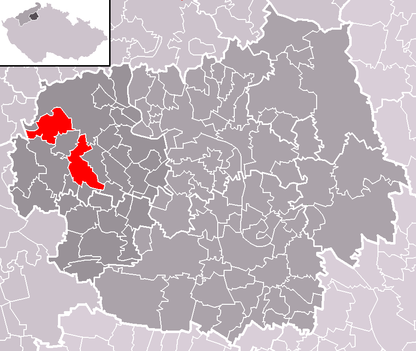
Čeština: Poloha města Třebenice v rámci okresu Litoměřice a správního obvodu obce s rozšířenou působností Lovosice. Území města je rozděleno ve dví katastrem obce Vlastislav.
English: Location of Třebenice municipality within Litoměřice District and administrative area of Lovosice as a Municipality with Extended Competence. Třebenice consists of two territories separated by municipality of Vlastislav. |
| Date | |
| Source | Self made, based on Image:ORP Lovosice LT CZ.png and Image:Map CZ - district Litomerice.PNG |
| Author | User:Miaow Miaow |
| Permission (Reusing this file) |
PD-self |
Licensing edit
| I, the copyright holder of this work, release this work into the public domain. This applies worldwide. In some countries this may not be legally possible; if so: I grant anyone the right to use this work for any purpose, without any conditions, unless such conditions are required by law. |
File history
Click on a date/time to view the file as it appeared at that time.
| Date/Time | Thumbnail | Dimensions | User | Comment | |
|---|---|---|---|---|---|
| current | 00:06, 22 October 2008 | | 854 × 722 (41 KB) | Miaow Miaow (talk | contribs) | {{Information |Description={{cs|Poloha města '''Třebenice''' v rámci okresu Litoměřice a správního obvodu obce s rozšířenou působností Lovosice. Území města je rozděleno ve dví katastrem obce Vlasti |
You cannot overwrite this file.
File usage on Commons
The following 9 pages use this file:
- Category:Churches in Třebenice (Litoměřice District)
- Category:Culture of Třebenice (Litoměřice District)
- Category:Deaths in Třebenice (Litoměřice District)
- Category:People of Třebenice (Litoměřice District)
- Category:Politicians from Třebenice (Litoměřice District)
- Category:Religion in Třebenice (Litoměřice District)
- Category:Sculptures in Třebenice (Litoměřice District)
- Category:Structures in Třebenice (Litoměřice District)
- Category:Třebenice (Litoměřice District)
File usage on other wikis
The following other wikis use this file:
- Usage on ceb.wikipedia.org
- Usage on cs.wikipedia.org
- Usage on es.wikipedia.org
- Usage on eu.wikipedia.org
- Usage on fr.wikipedia.org
- Usage on it.wikipedia.org
- Usage on lmo.wikipedia.org
- Usage on pt.wikipedia.org
- Usage on sk.wikipedia.org
- Usage on sv.wikipedia.org
- Usage on vi.wikipedia.org
- Usage on www.wikidata.org
- Usage on zh-min-nan.wikipedia.org