File:Tremhof.jpg
Size of this preview: 800 × 450 pixels. Other resolutions: 320 × 180 pixels | 640 × 360 pixels | 1,024 × 576 pixels | 1,280 × 720 pixels | 2,560 × 1,440 pixels | 5,376 × 3,024 pixels.
Original file (5,376 × 3,024 pixels, file size: 4.57 MB, MIME type: image/jpeg)
Captions
Captions
Add a one-line explanation of what this file represents
Summary edit
| Description |
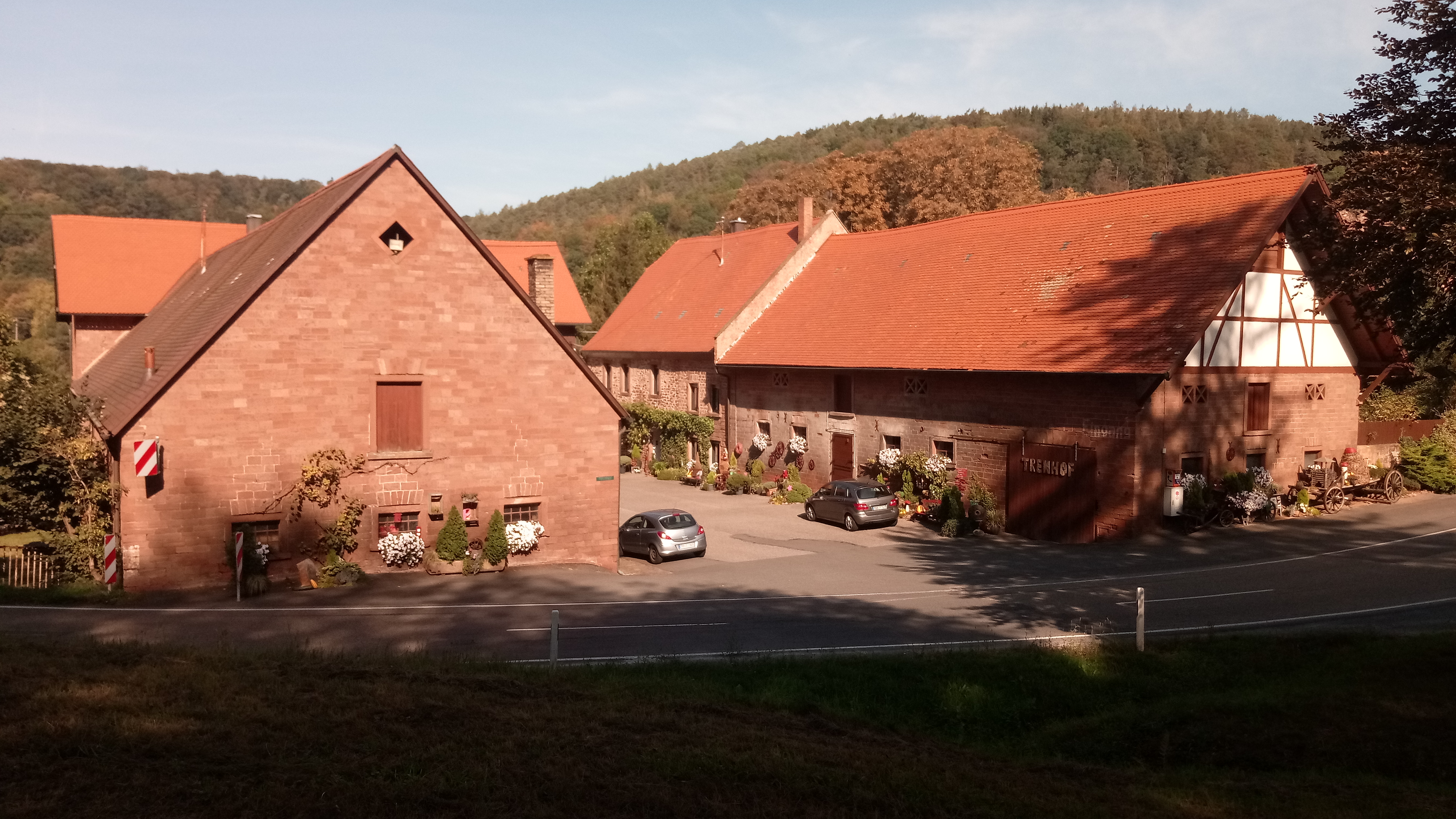
Deutsch: Der Tremhof (auch Hofgut Tremhof) ist ein Wohnplatz sowie ein ehemaliger Gutshof auf der Gemarkung des Freudenberger Stadtteils Boxtal im Main-Tauber-Kreis in Baden-Württemberg. |
| Date | 13 September 2020 (according to Exif data) |
| Source | Own work |
| Author | Granpar |
| Camera location | | View this and other nearby images on: OpenStreetMap |
|---|
_vor_dem_Tremhof_bei_Freudenberg-Boxtal_(Panorama).jpg)
Licensing edit
I, the copyright holder of this work, hereby publish it under the following license:
This file is licensed under the Creative Commons Attribution 3.0 Unported license.
- You are free:
- to share – to copy, distribute and transmit the work
- to remix – to adapt the work
- Under the following conditions:
- attribution – You must give appropriate credit, provide a link to the license, and indicate if changes were made. You may do so in any reasonable manner, but not in any way that suggests the licensor endorses you or your use.
| This file was uploaded via Mobile Android App (Commons mobile app) 2.12.3~dc08a5e88. |
File history
Click on a date/time to view the file as it appeared at that time.
| Date/Time | Thumbnail | Dimensions | User | Comment | |
|---|---|---|---|---|---|
| current | 08:46, 14 September 2020 | | 5,376 × 3,024 (4.57 MB) | Granpar (talk | contribs) | Uploaded using Commons Mobile App |
You cannot overwrite this file.
File usage on Commons
The following 4 pages use this file:
File usage on other wikis
The following other wikis use this file:
- Usage on de.wikipedia.org
- Usage on www.wikidata.org