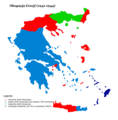
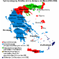
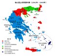
File:Triple occupation of Greece de.svg

Size of this PNG preview of this SVG file: 638 × 600 pixels. Other resolutions: 255 × 240 pixels | 511 × 480 pixels | 817 × 768 pixels | 1,090 × 1,024 pixels | 2,180 × 2,048 pixels | 812 × 763 pixels.
Original file (SVG file, nominally 812 × 763 pixels, file size: 109 KB)
File information
Structured data
Captions
Captions
Add a one-line explanation of what this file represents
İkinci Dünya Savaşı sırasında Yunanistan'ın işgali
Summary edit
| DescriptionTriple occupation of Greece de.svg |
Deutsch: Besetzung Griechenlands während des Zweiten Weltkriegs durch die Achsenmächte und Verbündete.
Ελληνικά: Χάρτης των ζωνών κατοχής της Ελλάδος από τις δυνάμεις του Άξονα (Γερμανια, Ιταλία, Βουλγαρία) κατά τον Β' ΠΠ.
English: Map of the 1941-1944 Axis Occupation of Greece. Depicted are the three occupation zones, plus the geographic regions and major urban centres.
Français : La triple occupation de la Grèce pendant la Seconde Guerre mondiale (1941-1945)
Italiano: Zone di occupazione tedesche, italiane e bulgare della Grecia durante la Seconda guerra mondiale
Polski: Okupacja Grecji (1941-1945) |
||
| Date | |||
| Source | Triple occuppation of Greece el.svg, made by infosfinaki (based on Triple occuppation of Greece.png, made by Cplakidas) | ||
| Author | Furfur | ||
| Permission (Reusing this file) |
|
||
| Other versions |
[edit]
|
||
| Validation/Created with InfoField | This vector image was created with Inkscape . |
File history
Click on a date/time to view the file as it appeared at that time.
| Date/Time | Thumbnail | Dimensions | User | Comment | |
|---|---|---|---|---|---|
| current | 01:21, 23 August 2021 |  | 812 × 763 (109 KB) | Praça de Maio (talk | contribs) | File uploaded using svgtranslate tool (https://svgtranslate.toolforge.org/). Added translation for tr. |
| 15:51, 4 March 2016 |  | 812 × 763 (92 KB) | Furfur (talk | contribs) | SVG-Fehler eliminiert, jetzt gültiger SVG code | |
| 15:39, 4 March 2016 |  | 812 × 763 (92 KB) | Furfur (talk | contribs) | Fehlerkorrekturen | |
| 15:14, 14 September 2013 |  | 1,158 × 1,147 (74 KB) | Furfur (talk | contribs) | Euböa ergänzt, kleinere Änderungen | |
| 15:09, 14 September 2013 |  | 1,158 × 1,147 (74 KB) | Furfur (talk | contribs) | Bildkosmetik + kleinere Fehler | |
| 15:01, 14 September 2013 |  | 1,158 × 1,147 (74 KB) | Furfur (talk | contribs) | {{Information |Description={{de|1=Besetzung Griechenlands während des Zweiten Weltkriegs durch die Achsenmächte und Verbündete.}} {{el|1=Χάρτης των ζωνών κατοχής της Ελλάδος από τις δυνάμεις του Άξο... |
You cannot overwrite this file.
File usage on Commons
The following 18 pages use this file:
- User:Magog the Ogre/Maps of conflicts/2016 March
- User:Magog the Ogre/Maps of conflicts/2021 August
- File:Gr-triple-occupation-ES.png
- File:Gr-triple-occupation-gr.png
- File:Gr-triple-occupation-Česky.JPG
- File:Gr-triple-occupation.png
- File:Occupation-de-la-grece-he.png
- File:Occupation de la grece (1941-1944) -fr.png
- File:PL-triple-occupation.png
- File:Tripla occupazione greca.gif
- File:Triple Occupation of Greece.png
- File:Triple occupation of Greece-zh.svg
- File:Triple occupation of Greece de.svg
- File:Triple occupation of Greece el.svg
- File:Triple occupation of Greece es.svg
- File:Triple occupation of Greece mk.svg
- File:Triple occuppation of Greece de.svg (file redirect)
- Template:Other versions/Occupation of Greece
File usage on other wikis
The following other wikis use this file:
- Usage on de.wikipedia.org
- Usage on sq.wikipedia.org
- Usage on tr.wikipedia.org
Metadata
This file contains additional information such as Exif metadata which may have been added by the digital camera, scanner, or software program used to create or digitize it. If the file has been modified from its original state, some details such as the timestamp may not fully reflect those of the original file. The timestamp is only as accurate as the clock in the camera, and it may be completely wrong.
| Width | 811.55249 |
|---|---|
| Height | 762.54767 |


