File:Trk78-Juelich.djvu

Size of this JPG preview of this DJVU file: 584 × 599 pixels. Other resolutions: 234 × 240 pixels | 468 × 480 pixels | 748 × 768 pixels | 998 × 1,024 pixels | 2,500 × 2,566 pixels.
Original file (2,500 × 2,566 pixels, file size: 1.01 MB, MIME type: image/vnd.djvu)
Captions
Captions
Add a one-line explanation of what this file represents
This panoramic image was created with Autostitch (stitched images may differ from reality).
Summary edit
| Description |
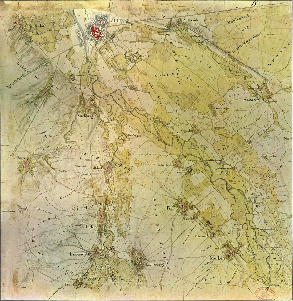
Deutsch: Historischen Kartenaufnahme der Rheinlande durch Tranchot und v. Müffling 1803-1820
|
||||
| Date | |||||
| Source | Tranchotkarte | ||||
| Author |
aufgenommen von Ing.-Geograph Maissiat (Scan & Repro) Kateer 21. Jan 2009 |
||||
| Permission (Reusing this file) |
|
||||
This file is in DjVu, a computer file format designed primarily to store scanned documents.
You may view this DjVu file here online. If the document is multi-page you may use the controls on the right of the image to change pages. You may also view this DjVu file in your web browser with a browser plugin/add-on, or use a desktop DjVu viewer for your operating system. You can choose suitable software from this list. See Help:DjVu for more information.
|
File history
Click on a date/time to view the file as it appeared at that time.
| Date/Time | Thumbnail | Dimensions | User | Comment | |
|---|---|---|---|---|---|
| current | 14:19, 10 July 2009 |  | 2,500 × 2,566 (1.01 MB) | Kateer (talk | contribs) | {{Information |Description={{de|1=Historischen Kartenaufnahme der Rheinlande durch Tranchot und v. Müffling 1803-1820 <br />'''Blatt 78 - Jülich''' <br /><br />''vorkommende Orte:'' * Altdorf * Alteburg * Bonsdorf * Bourheim * Daubenrath * Eilen * Frenz |
You cannot overwrite this file.
File usage on Commons
The following page uses this file:
File usage on other wikis
The following other wikis use this file:
- Usage on de.wikipedia.org