File:Turracherhoehe Ortsmitte01.jpg

Size of this preview: 800 × 533 pixels. Other resolutions: 320 × 213 pixels | 640 × 427 pixels | 1,024 × 683 pixels | 1,280 × 853 pixels | 1,800 × 1,200 pixels.
Original file (1,800 × 1,200 pixels, file size: 512 KB, MIME type: image/jpeg)
Captions
Captions
Add a one-line explanation of what this file represents
Summary edit
| Description |
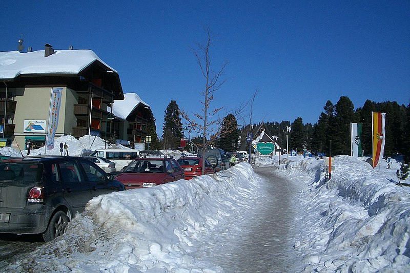
Deutsch: Turracherhöhe Ortsmitte; im Hintergrund Landesgrenze-Schild, rechts Landesfahnen Steiermark, Kärnten |
| Date | "created January 2006" |
| Source | Own record —KaHe 16:24, 29 January 2006 (UTC) |
| Author | —KaHe 16:24, 29 January 2006 (UTC) |
| Camera location | | View this and other nearby images on: OpenStreetMap |
|---|
Licensing edit
I, the copyright holder of this work, hereby publish it under the following license:
This file is licensed under the Creative Commons Attribution-Share Alike 2.5 Generic license.
- You are free:
- to share – to copy, distribute and transmit the work
- to remix – to adapt the work
- Under the following conditions:
- attribution – You must give appropriate credit, provide a link to the license, and indicate if changes were made. You may do so in any reasonable manner, but not in any way that suggests the licensor endorses you or your use.
- share alike – If you remix, transform, or build upon the material, you must distribute your contributions under the same or compatible license as the original.
File history
Click on a date/time to view the file as it appeared at that time.
| Date/Time | Thumbnail | Dimensions | User | Comment | |
|---|---|---|---|---|---|
| current | 16:24, 29 January 2006 | | 1,800 × 1,200 (512 KB) | KaHe (talk | contribs) | {{Information| |Description = Turracherhöhe Ortsmitte; im Hintergrund Landesgrenze-Schild, rechts Landesfahnen Steiermark, Kärnten |Source = Own record —~~~~ |Date = "created January 2006" |Author = —~~~~ |Permission |other_versions }} [[Category: |
You cannot overwrite this file.
File usage on Commons
The following 2 pages use this file:
File usage on other wikis
The following other wikis use this file:
- Usage on de.wikipedia.org
- Usage on en.wikipedia.org
- Usage on et.wikipedia.org
- Usage on sl.wikipedia.org
- Usage on uk.wikipedia.org