File:Two Harbors Minnesota aerial view.jpg
Size of this preview: 800 × 560 pixels. Other resolutions: 320 × 224 pixels | 640 × 448 pixels | 1,024 × 717 pixels | 1,280 × 896 pixels | 1,500 × 1,050 pixels.
Original file (1,500 × 1,050 pixels, file size: 674 KB, MIME type: image/jpeg)
Captions
Captions
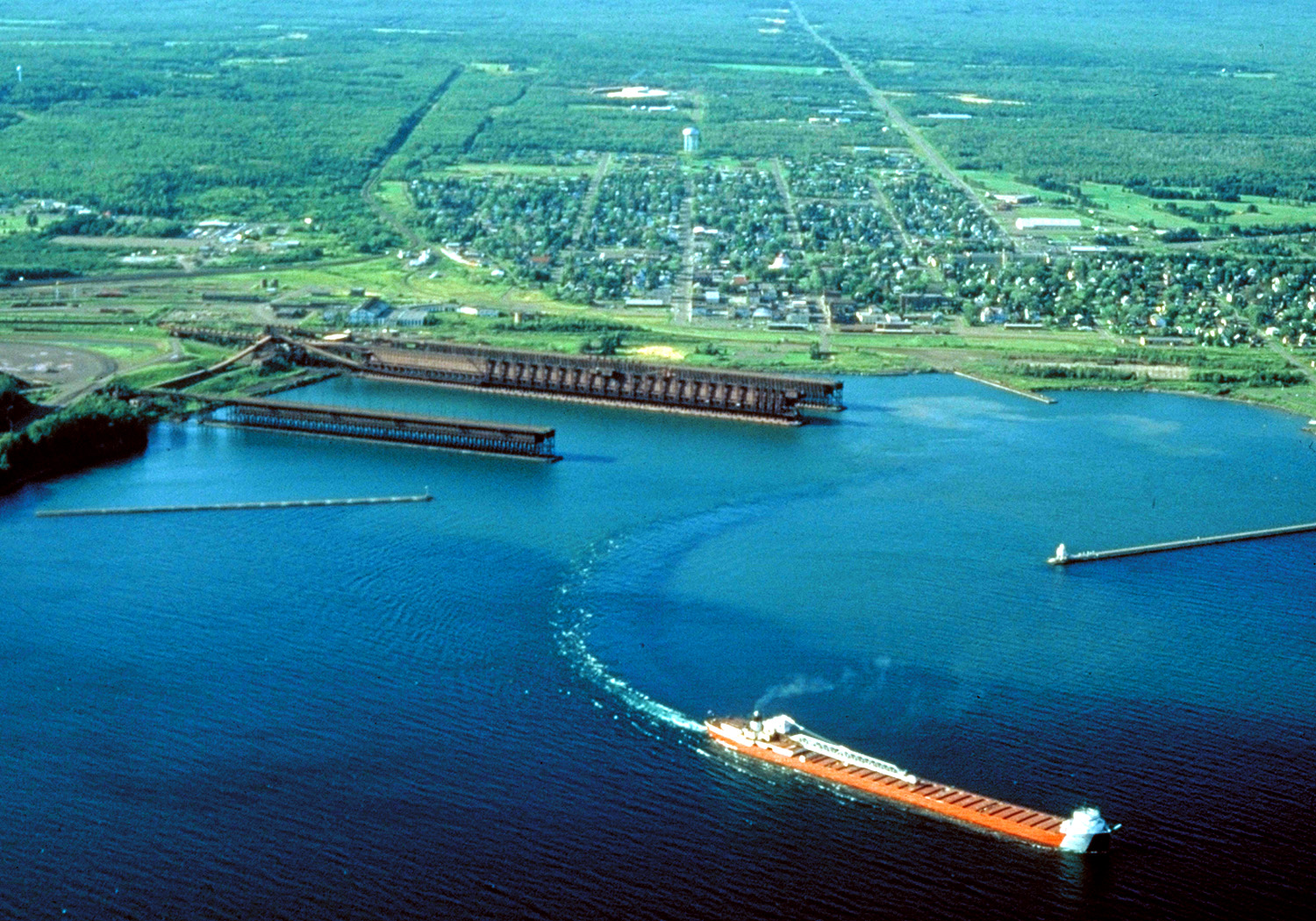
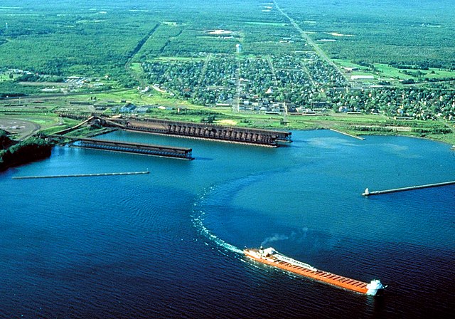
Aerial view of Two Harbors, Minnesota with a freighter departing the harbor.
| Description |
English: Aerial view of Two Harbors, Minnesota, on the north shore of Lake Superior. A Great lakes freighter is departing the harbor. |
|||
| Date | not specified or unknown, though judging by the view and visuals of the photo, the photo appears to have been taken some time in the mid-late 1990s. | |||
| Source |
U.S. Army Corps of Engineers Digital Visual Library Image page Image description page Digital Visual Library home page |
|||
| Author | U.S. Army Corps of Engineers, photographer not specified or unknown | |||
| Permission (Reusing this file) |
|
|||
| Location | Two Harbors, Lake County, Minnesota, USA |
| Camera location | | View this and other nearby images on: OpenStreetMap |
|---|
File history
Click on a date/time to view the file as it appeared at that time.
| Date/Time | Thumbnail | Dimensions | User | Comment | |
|---|---|---|---|---|---|
| current | 03:30, 30 March 2007 | | 1,500 × 1,050 (674 KB) | DanMS (talk | contribs) | {{Information | Description = {{en|Aerial view of Two Harbors, Minnesota, on the north shore of Lake Superior. A Great lakes freighter is departing the harbor.}} | Source = U.S. Army Corps of Engineers Digital Visual Library<br />[http://images |
You cannot overwrite this file.
File usage on Commons
The following 2 pages use this file:
File usage on other wikis
The following other wikis use this file:
- Usage on ar.wikipedia.org
- Usage on arz.wikipedia.org
- Usage on azb.wikipedia.org
- Usage on ca.wikipedia.org
- Usage on ceb.wikipedia.org
- Usage on ce.wikipedia.org
- Usage on de.wikipedia.org
- Usage on en.wikipedia.org
- Usage on en.wikivoyage.org
- Usage on es.wikipedia.org
- Usage on eu.wikipedia.org
- Usage on fa.wikipedia.org
- Usage on fr.wikipedia.org
- Usage on he.wikipedia.org
- Usage on ht.wikipedia.org
- Usage on hu.wikipedia.org
- Usage on ja.wikipedia.org
- Usage on ky.wikipedia.org
- Usage on lld.wikipedia.org
- Usage on pl.wikipedia.org
- Usage on pt.wikipedia.org
- Usage on ru.wikipedia.org
- Usage on sh.wikipedia.org
- Usage on sr.wikipedia.org
- Usage on sv.wikipedia.org
- Usage on tt.wikipedia.org
- Usage on uk.wikipedia.org
- Usage on uz.wikipedia.org
- Usage on vi.wikipedia.org
- Usage on www.wikidata.org
- Usage on zh-min-nan.wikipedia.org
- Usage on zh.wikipedia.org