File:Txu-oclc-6595921-nc30-15.jpg

Size of this preview: 792 × 600 pixels. Other resolutions: 317 × 240 pixels | 634 × 480 pixels | 1,015 × 768 pixels | 1,280 × 969 pixels | 2,560 × 1,938 pixels | 5,000 × 3,785 pixels.
Original file (5,000 × 3,785 pixels, file size: 5.02 MB, MIME type: image/jpeg)
Captions
Captions
Add a one-line explanation of what this file represents
Summary edit
| Description |
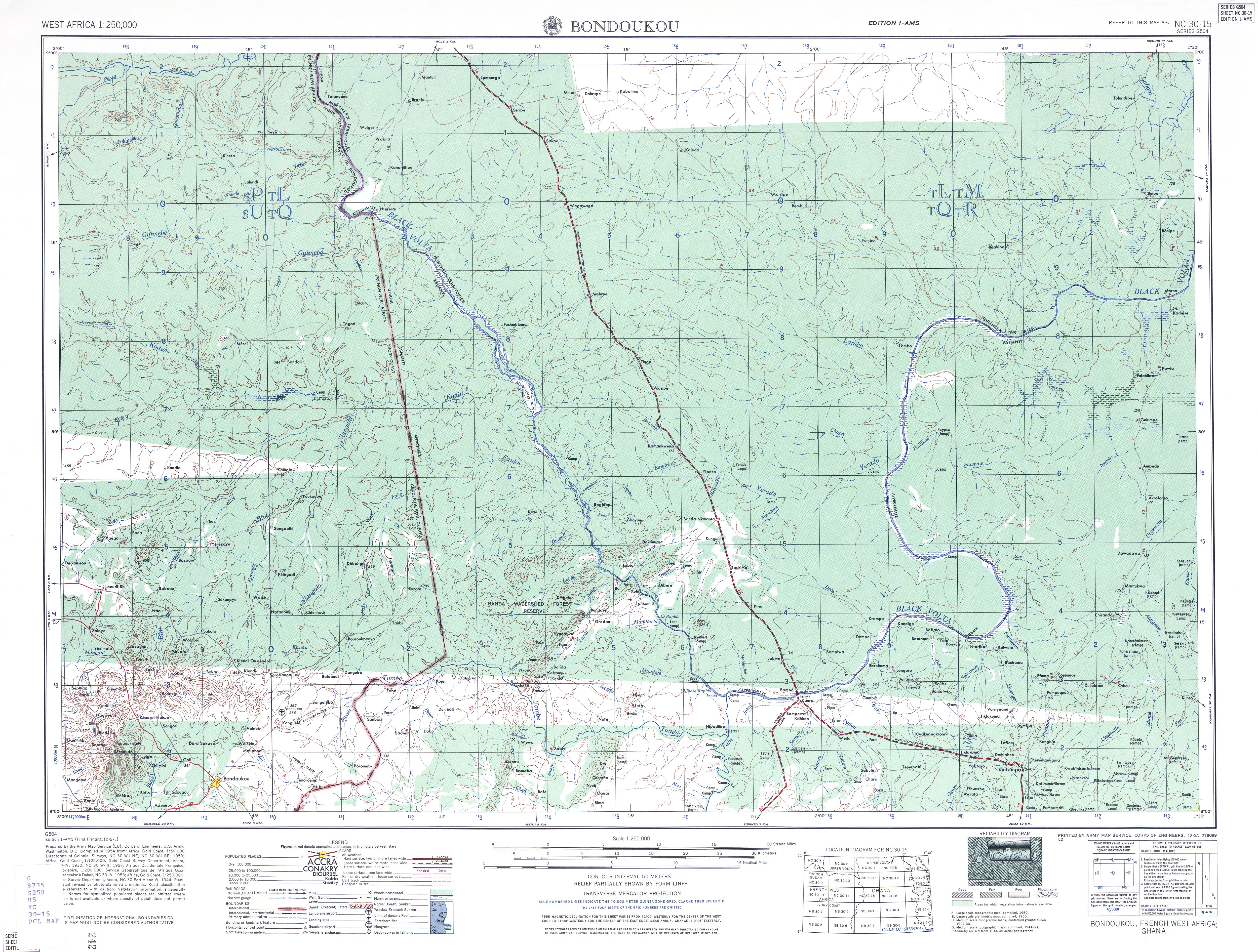
English: US Army map of West Africa, specifically the area along northern border of modern Ghana and Cote d'Ivoire (then Gold Coast Colony and French West Africa). |
| Date | |
| Source | http://www.lib.utexas.edu/maps/ams/west_africa/txu-oclc-6595921-nc30-15.jpg |
| Author | Army Map Service, US Army |
| Permission (Reusing this file) |
PD-US Government |
| Other versions | Derivative works of this file: Txu-oclc-6595921-nc30-15 crop southwest.jpg |
Licensing edit
This file is a work of a U.S. Army soldier or employee, taken or made as part of that person's official duties. As a work of the U.S. federal government, it is in the public domain in the United States.
|
 |
File history
Click on a date/time to view the file as it appeared at that time.
| Date/Time | Thumbnail | Dimensions | User | Comment | |
|---|---|---|---|---|---|
| current | 01:15, 13 September 2008 | | 5,000 × 3,785 (5.02 MB) | T L Miles (talk | contribs) | {{Information |Description={{en|1=US Army map of West Africa, specifically the area along northern border of modern Ghana and Cote d'Ivoire (then Gold Coast Colony and French West Africa).}} |Source=http://www.lib.utexas.edu/maps/ams/west_africa/txu-oclc- |
You cannot overwrite this file.
File usage on Commons
The following page uses this file:
File usage on other wikis
The following other wikis use this file:
- Usage on de.wikipedia.org